
- ��Ӱֱ��
- Travel Packages
- Top Destination
-
Travel Attraction
By Category
Top Attraction

- Travel Agents
- Car Rentals
- Hotels
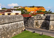
The Walled City, or "Ciudad Amurallada," is the historical heart of Cartagena, a beautiful port city located on the Caribbean coast of Colombia. This UNESCO World Heritage site is famed for its rich history, colonial architecture, and the iconic walls that protected the city from pirates and invaders centuries ago. A visit to the Walled City offers a fascinating glimpse into Cartagena's past while showcasing its vibrant modern-day culture. How to Reach Walled City, Cartagena Cartagena is well-connected to the rest of Colombia and the world, making it relatively easy to reach the Walled City. By Air: Rafael Núñez International Airport (CTG) serves Cartagena and is located about 5 kilometers from the Walled City. Direct flights are available from major Colombian cities such as Bogotá, Medellín, and Cali, as well as international flights from the US and Europe. By Bus: Cartagena is well-connected to other major cities in Colombia, including Barranquilla, Santa Marta, and Bogotá. Many bus services operate daily, offering an affordable way to travel. By Car: You can easily drive to Cartagena if you are coming from nearby cities along the coast, such as Barranquilla or Santa Marta. Cartagena is a popular tourist destination, and well-maintained highways make the trip convenient. Weather at Walled City, Cartagena Cartagena experiences a tropical climate, which means warm temperatures year-round. The average temperature is about 30°C (86°F). The best time to visit is during the dry season, from December to April, when the city is sunny and warm. However, even during the rainy season (May to November), the rains are usually brief and the city is still a popular destination. Timing of Visit to Walled City, Cartagena The Walled City can be explored throughout the day. However, to avoid the midday heat, it is recommended to visit in the early morning or late afternoon. Most businesses, attractions, and museums open from 9:00 AM to 5:00 PM, but some are open later, especially restaurants and bars in the evening. Why Walled City, Cartagena is Famous The Walled City of Cartagena is famous for its preservation of colonial architecture, its vibrant cultural scene, and its role in the history of the Caribbean region. The city's walls were built between the 16th and 18th centuries to protect it from pirates and foreign invaders. Today, these massive stone walls, along with cobblestone streets and colorful houses, transport visitors to another time. The Walled City is also known for its plazas, churches, museums, and the famous San Felipe de Barajas Castle, which offers stunning views of the city. Cartagena’s colonial charm mixed with its lively atmosphere makes it one of Colombia’s most visited destinations. Entry and Visit Details about Walled City, Cartagena Access to the Walled City is free. The area is a public space, and you can wander the streets and explore the many historic sites, cafes, and shops. While entry to the Walled City is free, some attractions within the city, such as museums, churches, and the castle, may require an entrance fee. These attractions often offer guided tours in English and Spanish, which can enhance your experience. History and Architecture of Walled City, Cartagena The Walled City’s history dates back to the 16th century when Cartagena was an important Spanish colonial port. The Spanish established the city and built impressive walls to protect against pirate attacks. Cartagena’s architecture is a mix of Spanish colonial and Caribbean influences, with its narrow streets, colorful houses, and balconies adorned with flowers. Key architectural landmarks include: Plaza Santo Domingo: A lively square surrounded by colonial buildings, cafes, and the iconic church of Santo Domingo. Palacio de la Inquisición: A colonial building that now serves as a museum showcasing Cartagena’s history, especially during the Spanish Inquisition. Castillo San Felipe de Barajas: A historic fortress offering panoramic views of Cartagena and a glimpse into the city’s military past. Things to Do in Walled City, Cartagena There is no shortage of things to do within the Walled City, whether you’re a history buff, a foodie, or someone looking for cultural experiences. Some of the top activities include: Walking Tours: Join a guided walking tour to explore the narrow streets, learn about Cartagena’s history, and admire its colonial architecture. Visiting the Museums: Explore the city's rich history through museums such as the Museum of the Inquisition and the Naval Museum of the Caribbean. Shopping: Shop for local handicrafts, jewelry, and Colombian goods in the many boutiques and artisanal markets. Dining: Cartagena is known for its fantastic food scene, with a variety of restaurants offering both Colombian and international cuisines. Evening Walks: In the evening, stroll through the beautifully lit streets, enjoy a drink at one of the many rooftop bars, or take in the live music at one of the plazas. Facts About Walled City, Cartagena The Walled City was declared a UNESCO World Heritage site in 1984. The city’s walls were constructed over 200 years, between the 16th and 18th centuries. The Walled City is home to several famous landmarks, including the San Felipe Castle and the Palace of the Inquisition. Cartagena was one of the most important ports during the Spanish colonial era, serving as a key trading hub and center for the slave trade. Tips for Visiting Walled City, Cartagena Wear Comfortable Shoes: The cobblestone streets can be uneven, so it’s essential to wear comfortable shoes for walking. Stay Hydrated: The weather can be hot and humid, so always carry water and stay hydrated during your explorations. Protect Yourself from the Sun: Make sure to wear sunscreen, a hat, and sunglasses to protect yourself from the sun. Respect the Local Culture: Cartagena is a vibrant city with a rich cultural heritage. Always be respectful of local customs and traditions when visiting. Take a Sunset Boat Tour: A boat tour around Cartagena’s bay at sunset provides a unique perspective of the city and its beautiful coastline.
Explore More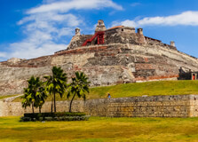
Castillo de San Felipo de Barajas
Castillo de San Felipe de Barajas is one of the most significant landmarks in Cartagena, Colombia. Located on a hill overlooking the city, this imposing fortress stands as a testament to the military history of the region. Built by the Spanish in the 16th century, it was designed to protect Cartagena from pirate attacks and foreign invasions. Today, Castillo de San Felipe de Barajas is one of Colombia’s most visited tourist attractions, offering a unique blend of history, architecture, and stunning views of the city. How to Reach Castillo de San Felipe de Barajas, Cartagena Castillo de San Felipe de Barajas is located just outside the Walled City, making it easily accessible from most parts of Cartagena. Here are the best ways to reach the castle: By Foot: If you are staying in the Walled City, you can walk to the castle in about 10 to 15 minutes. The walk is pleasant and offers views of Cartagena's streets and local life. By Taxi: Taxis are readily available throughout Cartagena. A short ride from the Walled City or other tourist areas will take you directly to the entrance of the castle. By Bus: There are public buses in Cartagena, though taxis and walking are generally more convenient for tourists. However, you can take a bus to the nearby neighborhood of Getsemaní, which is a short walk to the castle. Weather at Castillo de San Felipe de Barajas, Cartagena Cartagena enjoys a tropical climate with warm temperatures year-round. The weather at Castillo de San Felipe de Barajas is typically hot and humid, so it's best to plan your visit during the dry season (December to April) for more comfortable conditions. During the rainy season (May to November), expect occasional showers, though they are usually short and do not last all day. Temperatures average around 30°C (86°F), so wearing light, breathable clothing and staying hydrated is essential when exploring the castle grounds. Timing of Visit to Castillo de San Felipe de Barajas Castillo de San Felipe de Barajas is open to visitors daily. The general visiting hours are: Opening Hours: 8:00 AM to 6:00 PM (Monday to Sunday) Best Time to Visit: To avoid the midday heat, it's advisable to visit early in the morning or later in the afternoon. Evening visits are not allowed due to the site's closing time. The castle can get quite busy, especially during peak tourist seasons (December to March), so it’s better to visit early to enjoy a quieter experience. Why Castillo de San Felipe de Barajas is Famous Castillo de San Felipe de Barajas is famous for its impressive history and military significance. It is considered one of the most formidable fortresses built by the Spanish in the Americas. The castle was designed by Spanish engineer Sebastián de Belalcázar and was expanded over the centuries to withstand pirate attacks and military sieges. Its strategic location on the hill allowed for panoramic views of the city and the surrounding waters, making it a critical point of defense. Today, the castle is an iconic symbol of Cartagena’s colonial past and its resilience in the face of external threats. Visitors can explore its tunnels, walkways, and ramps while learning about the history of the Spanish empire in the Caribbean. Entry and Visit Details about Castillo de San Felipe de Barajas Visiting Castillo de San Felipe de Barajas is a must-do activity for anyone in Cartagena. Here are the entry details: Entry Fee: As of now, the general entrance fee is approximately 25,000 COP (Colombian pesos) for adults, with discounts available for students, children, and senior citizens. Prices may vary, so it’s best to check before your visit. Guided Tours: While you can explore the castle on your own, guided tours are available in both Spanish and English. A guided tour offers deeper insight into the history, architecture, and strategic importance of the castle. Accessibility: The castle is accessible by foot, but be prepared for a bit of a climb to reach the top. The views from the top are worth the effort! Some areas of the castle, such as the tunnels, may be difficult for visitors with mobility issues. History and Architecture of Castillo de San Felipe de Barajas The construction of Castillo de San Felipe de Barajas began in 1536, and it was continually expanded and reinforced over the next 200 years. The fortress was designed by the Spanish to protect Cartagena from pirates and foreign invaders. The location on a hill provided an excellent vantage point to monitor any approaching threats from the sea. One of the key features of the castle is its complex network of tunnels, which were used for defense purposes and as escape routes in times of siege. The architecture reflects the military ingenuity of the time, with curved walls and strategic placement of cannons designed to maximize the fortress’s ability to defend the city. The fort’s triangular shape and elevated position made it almost impenetrable, and it played a crucial role in protecting Cartagena from several attempted invasions. Things to Do in Castillo de San Felipe de Barajas While at Castillo de San Felipe de Barajas, there are several activities you can enjoy to make the most of your visit: Explore the Tunnels: The castle has an intricate system of tunnels that you can explore. These tunnels were used as defense mechanisms and escape routes during sieges. They offer a fascinating look at military engineering from the colonial era. Enjoy the Views: The castle offers panoramic views of Cartagena, the Caribbean Sea, and the surrounding area. It’s a great spot to take photos and admire the city from above. Learn the History: Visit the information boards around the castle to learn about its history, including the various battles and sieges that occurred during its long existence. Take a Guided Tour: A guided tour is an excellent way to delve deeper into the history and significance of the castle. Knowledgeable guides will take you through the history of the fortress and share interesting anecdotes about its role in Cartagena’s defense. Facts About Castillo de San Felipe de Barajas The castle is named after Saint Philip of Barajas, a Spanish king. It was declared a UNESCO World Heritage Site in 1984 as part of the historic center of Cartagena. The construction of the castle spanned over two centuries, with major improvements made in the 17th and 18th centuries. The castle played a key role in the defense of Cartagena against several pirate attacks, including the famous attack by the British in 1741. It is considered one of the most impressive military structures built by the Spanish in the Americas. Tips for Visiting Castillo de San Felipe de Barajas Wear Comfortable Shoes: The castle is large and involves a lot of walking, including some steep climbs. Comfortable shoes are essential for a pleasant visit. Stay Hydrated: The heat in Cartagena can be intense, so be sure to carry water and stay hydrated throughout your visit. Visit Early or Late: To avoid the crowds and the midday sun, visit the castle early in the morning or later in the afternoon. Bring a Hat and Sunscreen: The sun can be quite strong, especially during the dry season, so it's a good idea to bring a hat and apply sunscreen. Photography: Don’t forget your camera! The views from the top of the castle are spectacular, and there are plenty of opportunities for great photos.
Explore More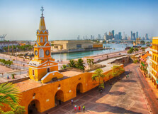
The Torre del Reloj, or Clock Tower, is one of Cartagena's most iconic landmarks and a symbol of the city's colonial past. Situated at the entrance to the Walled City, this monumental structure was built in the 18th century and has been a central feature of Cartagena’s cityscape for over 300 years. The Torre del Reloj not only serves as a visual focal point but also holds significant historical and cultural value for both locals and tourists alike. Its striking design and location make it one of the most photographed spots in Cartagena. How to Reach Torre del Reloj, Cartagena Torre del Reloj is located in the heart of Cartagena's historic district, just outside the Walled City. It is one of the first sights that visitors encounter when entering the Old Town. Here are the best ways to reach Torre del Reloj: By Foot: The Torre del Reloj is centrally located, and if you're staying in or around the Walled City, you can easily walk to it. The walk offers a chance to explore Cartagena’s charming streets and historic squares. By Taxi: Taxis are readily available throughout Cartagena, and you can reach Torre del Reloj in just a few minutes from most parts of the city. A short taxi ride is both affordable and convenient. By Bus: Public buses in Cartagena are an option, but they are not as reliable or efficient for tourists. However, there are bus stops near the Torre del Reloj if you prefer public transport. Weather at Torre del Reloj, Cartagena Cartagena is known for its warm, tropical climate, and the weather around the Torre del Reloj is no exception. With average temperatures hovering around 30°C (86°F) year-round, it is important to prepare for the heat, especially if you're visiting during the peak of the day. The best time to visit is during the dry season, from December to April, when you can expect sunny skies and minimal rain. The rainy season, which lasts from May to November, brings brief but frequent showers, particularly in the afternoon. However, rain rarely disrupts travel plans as the storms are usually short-lived. Timing of Visit to Torre del Reloj The Torre del Reloj is visible and accessible at all times of day, but the surrounding area can be more enjoyable at certain hours. Since it's located in a busy area, it can get crowded, particularly in the late afternoon and evening when tourists and locals alike gather for leisurely strolls and photos. Here are the recommended visiting times: Best Time to Visit: Early morning or late afternoon are the best times to visit, as the weather is cooler and the crowds are smaller. This is also the best time for photos, as the light is softer and more flattering. Evening: At night, Torre del Reloj is beautifully illuminated, making it a great spot to visit if you're interested in seeing it in a different light. Why Torre del Reloj is Famous Torre del Reloj is famous for several reasons. As one of Cartagena's oldest and most recognizable structures, it stands as a symbol of the city’s colonial heritage and resilience. The clock tower marks the main entrance to the walled city and serves as a gateway to the historic center of Cartagena. Historically, the tower was part of the city walls and the nearby entrance gate, known as the "Puerta del Reloj." The clock was installed in the 18th century and has continued to mark the passage of time in Cartagena ever since. Over the years, the Torre del Reloj has become a symbol of the city’s rich past, cultural heritage, and importance as a major port in the Caribbean during the Spanish colonial era. Entry and Visit Details about Torre del Reloj Unlike some other historical sites in Cartagena, Torre del Reloj does not have an entrance fee for visitors. It is located in a public area, and you can walk around the square and take photos freely. While the tower itself is a landmark, visitors typically explore the surrounding area, which includes the historic streets, plazas, and markets of Cartagena's Old Town. Although the tower is not open for tours inside, visitors can still enjoy its beautiful architecture and the surrounding atmosphere. Many tourists use Torre del Reloj as a starting point to explore the Walled City and the other nearby attractions, including the Plaza de los Coches, the San Pedro Claver Church, and the Palacio de la Inquisición. History and Architecture of Torre del Reloj The Torre del Reloj was originally built in 1610 as part of the city walls, which were constructed to defend Cartagena from pirate attacks and foreign invaders. The tower was initially part of the “Puerta del Reloj” (Clock Gate), the main entrance to the walled city. The clock itself was added in 1701, and it has been working ever since, marking the passage of time for the city’s inhabitants and visitors alike. The architecture of the Torre del Reloj is an elegant mix of Baroque and Spanish colonial styles, with its yellow façade, grand clock face, and arched windows. The tower stands out against the skyline of the city with its distinct color and design, and it is an enduring symbol of Cartagena’s colonial past. Over the centuries, the Torre del Reloj has been renovated and restored, yet it still retains its original charm and historical significance. Its strategic location at the entrance of the Walled City ensures that it remains a focal point of the city's public life and a popular destination for tourists. Things to Do at Torre del Reloj While Torre del Reloj itself is primarily an architectural landmark, there are several things to do around the area that enhance the experience of visiting this historic site: Stroll Around Plaza de los Coches: The Plaza de los Coches is a bustling square located right in front of Torre del Reloj. It's a great place to relax, people-watch, and enjoy the lively atmosphere of Cartagena. Take Photos: The Torre del Reloj is one of the most photographed landmarks in Cartagena. Be sure to capture its beauty from various angles, especially at sunrise or sunset. Explore the Walled City: After visiting the Torre del Reloj, wander through the historic streets of the Walled City. You’ll find beautiful colonial architecture, vibrant plazas, shops, and restaurants. Visit Nearby ��Ӱֱ��: Several notable attractions are within walking distance, including the San Pedro Claver Church, the Inquisition Palace, and the City Hall. Facts About Torre del Reloj The Torre del Reloj was originally built as part of the city walls in 1610. The clock was added in 1701, making it an integral part of Cartagena’s history. The tower stands at 35 meters (115 feet) tall and is an iconic feature of the Walled City’s entrance. It is the first thing that travelers see when entering the Walled City from the harbor, making it a symbol of Cartagena. The tower’s design is a blend of Baroque and Spanish colonial architecture, with a yellow façade and ornate details. Tips for Visiting Torre del Reloj Wear Comfortable Shoes: The area around Torre del Reloj is pedestrian-friendly, but you will be walking around cobblestone streets. Comfortable shoes are a must! Arrive Early or Late: For the best photo opportunities and a more peaceful visit, try to arrive early in the morning or later in the evening when the crowds are thinner. Stay Hydrated: Cartagena can be hot and humid, so carry water with you and stay hydrated as you explore the area. Don’t Miss the Surrounding Area: While visiting Torre del Reloj, take the time to explore the nearby attractions, including the nearby plazas and historic landmarks. Check for Events: Occasionally, the square around Torre del Reloj hosts events, including festivals and concerts. Check the local schedule to see if anything coincides with your visit.
Explore More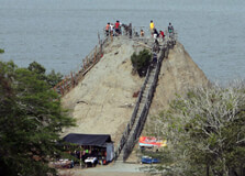
Volcán del Totumo, also known as the Totumo Mud Volcano, is one of the most unique natural attractions near Cartagena, Colombia. Located about 50 kilometers (31 miles) northeast of Cartagena, the volcano is famous for its therapeutic mud baths, where visitors can immerse themselves in warm, mineral-rich mud. This volcanic mud is believed to have healing properties and is a popular attraction for both locals and tourists looking for a unique and relaxing experience. The site has gained popularity due to its distinctiveness and the stunning contrast of the surrounding lush landscape with the earthy, grey mud inside the crater. How to Reach Volcán del Totumo, Cartagena Reaching Volcán del Totumo from Cartagena is fairly easy, as it is located a short distance from the city. Here are the best ways to get to the volcano: By Car: If you’re driving, the trip from Cartagena to the volcano takes about 1 to 1.5 hours. The most direct route is through the road leading to the town of Santa Catalina, which is home to the volcano. There are clear signs that will guide you to the site once you get closer. By Taxi: Taxis are an excellent option for reaching Volcán del Totumo, as they offer a convenient and direct ride from your accommodation. The cost for a round-trip taxi ride can range from 100,000 to 150,000 COP (Colombian pesos), depending on your location and bargaining skills. By Organized Tour: Many local tour operators offer guided trips to the volcano, which typically include transportation, a guide, and other services. These tours are popular and convenient if you prefer a structured visit with the option of learning more about the area and its history. Public Transportation: Public buses to Santa Catalina are available from Cartagena’s bus terminal, but this option requires more effort and time. It may not be as convenient, especially for first-time visitors. Weather at Volcán del Totumo, Cartagena The climate around Volcán del Totumo is tropical, characterized by high temperatures and humidity year-round. The region typically experiences temperatures between 27°C and 32°C (81°F to 89°F), making it warm for most of the year. It’s essential to be prepared for both the heat and humidity when visiting. The best time to visit Volcán del Totumo is during the dry season, which runs from December to April. During this time, the weather is generally sunny and pleasant. However, even during the rainy season (May to November), the volcano remains open, though brief showers may occur in the afternoon. The volcanic mud remains consistent and enjoyable regardless of the weather. Timing of Visit to Volcán del Totumo Volcán del Totumo is open every day of the week, and visitors are welcome from early morning until late afternoon. The recommended visiting hours are: Opening Hours: 9:00 AM to 5:00 PM (Monday to Sunday) Best Time to Visit: To avoid the midday crowds and heat, the best times to visit are in the morning (around 9:00 AM to 11:00 AM) or in the late afternoon (3:00 PM to 5:00 PM). This gives you a chance to experience the mud bath in cooler conditions and with fewer visitors. It is advisable to arrive early to avoid the crowds that can build up later in the day, especially during the peak tourist season (December to March). Why Volcán del Totumo is Famous Volcán del Totumo is famous for its unique mud baths. Visitors climb to the top of the crater and submerge themselves in the warm, viscous mud inside the volcano. The mud is rich in minerals, and it is said to have therapeutic properties, including skin rejuvenation and relaxation. People from all over the world visit to experience the supposed health benefits of the mud, as well as the fun of floating in the soft, thick substance. Beyond its medicinal qualities, the volcano’s beauty and distinctive appearance contribute to its fame. The surrounding area is lush with greenery, and the contrast of the vibrant jungle and the grey, viscous mud creates an unforgettable and unusual scene for photos. The experience of being covered in mud is both relaxing and memorable, and the hot springs in the nearby area are a perfect complement to the overall visit. Entry and Visit Details about Volcán del Totumo The entrance fee to Volcán del Totumo is relatively affordable and typically includes access to the mud baths and showers to clean off afterward. Here are some essential details about visiting the volcano: Entry Fee: The standard entry fee is around 15,000 to 25,000 COP per person, depending on the time of year and the tour operator (if applicable). This fee grants you access to the mud baths, where you can enjoy the therapeutic experience of immersing yourself in the volcanic mud. Mud Bath: The mud bath experience usually lasts around 20-30 minutes. The mud is warm and thick, offering a relaxing floating experience. There are staff members on-site to assist you and help you get into and out of the mud bath safely. Shower Facilities: After enjoying the mud bath, there are showers nearby where you can rinse off the mud. Many visitors enjoy being cleaned by locals who offer to wash off the mud for a small tip (usually around 5,000 COP). Facilities: Basic facilities such as changing rooms, lockers, and restrooms are available at the site, so you can store your belongings safely and change before and after the mud bath. History and Architecture of Volcán del Totumo Volcán del Totumo is not a traditional, active volcano that erupts with lava. Instead, it is a small mud volcano that emits mineral-rich mud from the earth. The origins of the volcano are thought to be related to the region’s tectonic activity, which causes underground pressure to push mud and gases to the surface. The volcano's architectural features are simple but functional. The site consists of a small crater filled with thick mud, surrounded by a set of platforms and steps for visitors to climb. There are small wooden structures that provide shade and seating, allowing guests to rest before and after their experience in the mud. Though Volcán del Totumo is not known for its architecture, its natural beauty and the cultural aspects surrounding the site make it a unique destination for visitors to Cartagena. Things to Do at Volcán del Totumo There are a few exciting activities that visitors can enjoy when visiting Volcán del Totumo: Take a Mud Bath: The main attraction at Volcán del Totumo is, of course, the mud bath itself. The experience of floating in warm volcanic mud is both therapeutic and fun, and it is something you can only do at this particular site. Get a Mud Massage: Locals at the volcano offer massages while you are in the mud, which enhances the relaxing experience. A small tip (around 5,000 to 10,000 COP) is usually given to the masseurs for their service. Rinse Off and Relax in the Nearby Hot Springs: After your mud bath, enjoy a refreshing rinse under the outdoor showers, and then take a dip in the nearby hot springs or a local water source to relax your muscles. Explore the Surrounding Nature: The area surrounding the volcano is lush with tropical greenery. Take a walk through the landscape or enjoy the view from the top of the volcano. Facts About Volcán del Totumo The volcano is about 20 meters (66 feet) tall, and its crater is filled with warm, mineral-rich mud. It is one of the few mud volcanoes in the world, and it is a popular tourist attraction in Cartagena. The therapeutic mud is believed to have healing properties, particularly for skin conditions and joint pain. The volcano has been a local attraction for many years, with people coming to bathe in its mud for health benefits long before it became a popular tourist spot. Tips for Visiting Volcán del Totumo Bring a Towel and Swimsuit: Don’t forget to bring a towel, swimsuit, and a change of clothes for afterward. Be Ready for the Mud: The mud can get messy, so be prepared to get dirty. Wear clothing you don’t mind getting muddy, and bring extra water to rinse off. Be Cautious of the Sun: The area can get hot, especially during midday, so wear sunscreen or a hat to protect yourself from the sun. Give Tips for Service: Local staff may offer to help you with the mud bath experience or cleaning afterward. It is customary to tip them for their assistance.
Explore More
The Rosario Islands (Islas del Rosario) are a stunning archipelago located about 100 kilometers (62 miles) from Cartagena, Colombia. This tropical paradise is made up of 27 small islands, each offering its own unique beauty and charm. The islands are part of the Rosario and San Bernardo Corals National Natural Park, known for its vibrant coral reefs, crystal-clear waters, and white sandy beaches. The Rosario Islands are famous for their biodiversity, making it a popular destination for tourists seeking relaxation, adventure, and nature in its purest form. How to Reach Rosario Islands, Cartagena Getting to the Rosario Islands from Cartagena is straightforward, and there are several options depending on your preferences for speed, comfort, and budget: By Boat: The most common way to reach the Rosario Islands is by boat. There are daily boat departures from the Muelle de la Bodeguita pier in Cartagena to various islands in the archipelago. The boat ride takes approximately 1.5 to 2 hours, depending on which island you are visiting. You can choose from public boats, which are more affordable, or private tours for a more personalized experience. By Private Yacht: For a more luxurious and private experience, you can rent a yacht or speedboat to take you to the islands. Several companies in Cartagena offer yacht rentals for group or private tours to the Rosario Islands. By Air (Charter Flights): For those seeking speed and luxury, some private charter flights are available, although this is a much more expensive option. The flight typically takes about 30 minutes and lands on a nearby airstrip on one of the larger islands in the Rosario archipelago. Weather at Rosario Islands, Cartagena The weather in the Rosario Islands is tropical, with warm temperatures and high humidity throughout the year. The average temperature hovers around 28°C (82°F), making it an ideal destination for beach lovers. The islands have a dry and wet season, though the weather remains pleasant year-round. Dry Season: The best time to visit the Rosario Islands is during the dry season, which lasts from December to April. During this period, the skies are clear, and the sea is calm, making it perfect for water activities like snorkeling and diving. Rainy Season: The rainy season from May to November brings brief but frequent showers. While the rain may disrupt some outdoor activities, the islands are still beautiful to visit, and the rain usually doesn't last long. Timing of Visit to Rosario Islands The Rosario Islands are a popular day-trip destination from Cartagena, though some visitors opt to stay overnight. The most common visit duration is a full day trip, typically from 8:00 AM to 4:00 PM. If you're planning a day trip, it’s recommended to depart early in the morning to make the most of your time at the islands and return to Cartagena in the late afternoon. For those looking for a more leisurely experience, staying at one of the island resorts for a few days can allow for a more relaxed pace, giving you time to explore multiple islands, enjoy water sports, and soak in the natural beauty of the archipelago. Why Rosario Islands are Famous The Rosario Islands are famous for their pristine beaches, crystal-clear waters, and vibrant coral reefs. The islands offer an excellent opportunity to explore marine life, with snorkeling and diving being the top activities. The coral reefs around the islands are home to a wide variety of tropical fish, sea turtles, and even rays, making it a haven for marine enthusiasts. Additionally, the Rosario Islands are part of the Rosario and San Bernardo Corals National Natural Park, which is one of Colombia’s most important protected marine areas. The natural park is dedicated to preserving the unique biodiversity of the region, and it attracts nature lovers, conservationists, and eco-tourists. The islands are also a popular destination for relaxation, offering visitors the chance to unwind in a peaceful setting far from the hustle and bustle of Cartagena’s city life. Entry and Visit Details about Rosario Islands Visiting the Rosario Islands doesn’t require any special permits for most tourists, and entry is free for most of the islands. However, some private islands or resorts may charge an entry fee, especially if you are planning to stay overnight or use their facilities. Entry Fee: Public access to the Rosario Islands is free; however, if you want to visit certain private islands or resorts, you may be required to pay an entrance fee. Resorts typically charge for access to their amenities, including beach areas, restaurants, and water sports facilities. Tour Packages: Many visitors prefer to book a guided tour to the Rosario Islands, which includes transportation, lunch, and access to designated spots on the islands. These tours can range from budget-friendly group tours to luxury private excursions, and they often include stops for snorkeling and other activities. Island Resorts: Some of the islands are home to luxury resorts that offer all-inclusive packages for guests. These resorts usually provide beach access, dining, water sports, and even spa services. These resorts offer a more luxurious and private experience compared to public access beaches. History and Architecture of Rosario Islands The history of the Rosario Islands dates back to the colonial period when the islands were originally used by Spanish settlers for their strategic position along the Caribbean coast. During the 19th century, the islands were used for various purposes, including military defense and as fishing grounds. However, it wasn’t until the 20th century that the Rosario Islands began to gain attention as a tourist destination, thanks to their natural beauty and potential for eco-tourism. The islands do not have much in terms of architectural landmarks, as they are primarily known for their natural beauty. The local architecture is simple and functional, with the occasional beach hut or resort facility. The majority of the buildings on the islands are designed to blend into the natural environment, allowing visitors to focus on the pristine surroundings. Things to Do at Rosario Islands There is no shortage of activities to enjoy at the Rosario Islands. Here are some of the most popular things to do: Snorkeling and Scuba Diving: The crystal-clear waters and vibrant coral reefs make the Rosario Islands a premier destination for snorkeling and diving. Visitors can explore the rich marine life, including colorful fish, coral formations, and sea turtles. Relax on the Beaches: Each island has beautiful, sandy beaches, perfect for lounging in the sun or taking a refreshing dip in the warm Caribbean waters. Visit the Oceanarium: Located on one of the islands, the Oceanarium is a small marine park where you can see various species of marine life, including sharks, dolphins, and turtles. It’s a great place for families with children. Kayaking and Paddleboarding: The calm, clear waters around the islands are ideal for kayaking and paddleboarding. These activities are available at many of the resorts and tour operators on the islands. Take a Boat Tour: You can take a boat tour around the Rosario Islands, which will allow you to see the islands from the water and visit multiple spots in a single day. Many tours include stops for swimming, snorkeling, or simply relaxing on secluded beaches. Facts About Rosario Islands The Rosario Islands are part of the Rosario and San Bernardo Corals National Natural Park, one of the most important marine protected areas in Colombia. The archipelago is made up of 27 islands, although only a few are developed for tourism. The islands are known for their diverse marine life, with over 200 species of fish and several species of coral. The Rosario Islands have been designated a UNESCO Biosphere Reserve, highlighting their ecological importance. Tips for Visiting Rosario Islands Bring Sunscreen: The sun can be intense, so make sure to apply sunscreen before heading out to the islands, especially if you plan on spending a lot of time at the beach. Stay Hydrated: The tropical heat can be draining, so carry water with you to stay hydrated during your visit. Book Tours in Advance: If you want to visit specific islands or resorts, it’s recommended to book your boat tour or resort stay in advance, particularly during peak tourist seasons (December to April). Respect the Environment: The Rosario Islands are part of a protected marine park, so be sure to follow all environmental regulations, avoid littering, and be mindful of local wildlife.
Explore More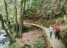
Medellín, Colombia, is known for its transformation and innovation, and one of the most significant features of this city is the Metrocable system, which connects some of the city’s most remote areas to the main urban center. Additionally, Parque Arví is an incredible natural park located in the outskirts of Medellín, offering visitors a beautiful escape into nature. This combination of urban transit and natural beauty makes the Metrocable and Parque Arví experience a must-visit for anyone exploring the city. How to Reach Metrocable and Parque Arví, Medellín Reaching Metrocable and Parque Arví is easy thanks to Medellín's efficient public transport system. The Metrocable is part of the city's metro system and connects the upper neighborhoods of the city with the metro stations below. To visit Parque Arví, you can take the Metrocable Line K, which begins at the Santo Domingo metro station. The ride offers panoramic views of the city and the surrounding mountains. Once you reach the last station, “Arví”, you will be at the park’s entrance. If you're coming from the city center, you can easily reach the Metrocable by taking the Medellín metro. The ride from the city center to the Santo Domingo station takes around 15 to 20 minutes. From there, take the Metrocable Line K to the Arví station. The journey offers a stunning view of the mountains, the city below, and a glimpse into the areas of Medellín that are otherwise difficult to access. Weather at Metrocable and Parque Arví, Medellín Medellín enjoys a pleasant, mild climate year-round, often referred to as the "City of Eternal Spring" because of its consistently moderate temperatures. The temperature in the city typically ranges from 22°C to 28°C (72°F to 82°F), while the higher altitudes near Parque Arví can be slightly cooler, especially in the mornings and evenings. It’s advisable to bring a light jacket if you plan to visit the park in the early morning or late afternoon. Rain is common, particularly in the afternoon, so it's a good idea to carry an umbrella or raincoat just in case. Timing for Metrocable and Parque Arví, Medellín The Metrocable operates daily from 5:00 AM to 10:00 PM. However, the timing for the Metrocable that leads to Parque Arví may vary slightly, so it's important to check before you go. The park itself is open from 8:00 AM to 5:00 PM. If you're planning to explore the park or take part in guided tours, it’s best to arrive early to make the most of your time there. Why Metrocable and Parque Arví are Famous The Metrocable system is famous for being a key part of Medellín’s public transport network, providing residents of the steep, mountainous areas access to the city center. It was designed as a solution to improve mobility and connect communities that were previously isolated due to the city’s geography. What makes the Metrocable particularly noteworthy is its integration into the urban fabric, offering an elevated and scenic way to travel through the city. Parque Arví, on the other hand, is famous for its lush natural beauty, rich biodiversity, and the opportunity to escape the hustle and bustle of Medellín. The park covers 16,000 hectares of forest, offering a peaceful retreat with trails for hiking, biking, and exploring. It's also a site of cultural heritage with archaeological evidence of pre-Hispanic civilizations. The combination of culture, nature, and accessibility through the Metrocable makes it an iconic spot in Medellín. Entry and Visit Details about Metrocable and Parque Arví To use the Metrocable, you will need to purchase a ticket for the Medellín metro system. The price of a metro ticket is relatively inexpensive and can be purchased at any metro station. For a single ride on the Metrocable, the cost is similar to a standard metro ride. When visiting Parque Arví, there is a small entry fee to access the park. The cost of admission is generally around 5,000 to 10,000 COP (Colombian Pesos). There are also additional costs if you wish to take part in specific activities, such as guided tours, bike rentals, or other recreational services. It’s best to check the park’s official website for up-to-date prices and schedules. History and Architecture of Metrocable and Parque Arví The Metrocable system was inaugurated in 2004 as part of Medellín’s broader efforts to modernize and improve the quality of life in its urban and rural communities. The system was designed by the city’s metro company, and it was the first cable car in the world to be integrated into a metro system. The architecture of the Metrocable stations is modern, with sleek, minimalistic designs that blend well with the natural environment. Parque Arví, however, has a long history dating back to before the Spanish conquest. Archaeological evidence suggests that the area was inhabited by indigenous peoples long before the arrival of Europeans. Today, the park is a protected natural area, and much of its original forest ecosystem is still intact. The architecture of the park is centered around sustainability and eco-tourism, with buildings designed to blend in with the surrounding landscape. Things to Do at Metrocable and Parque Arví There is no shortage of things to do when visiting Metrocable and Parque Arví. The Metrocable ride itself is an experience, offering breathtaking views of Medellín and its surrounding areas. It is also a practical way to travel to various neighborhoods in the city. However, the real magic lies in Parque Arví. At Parque Arví, visitors can enjoy a range of activities such as hiking, bird watching, biking, and exploring the park's many trails. The park is also home to many species of flora and fauna, making it a great place for nature lovers. For those interested in culture, there are guided tours that explain the park's rich history and the significance of the indigenous cultures that once inhabited the region. You can also visit the park's ecological farms and participate in workshops related to environmental sustainability. Facts and Tips about Metrocable and Parque Arví Fact 1: The Metrocable system is considered a symbol of Medellín’s urban transformation and is a model for other cities worldwide. Fact 2: Parque Arví is a biological and archaeological reserve, and it is home to diverse ecosystems and wildlife. Fact 3: You can rent bicycles and other equipment at Parque Arví for an additional fee. Tip 1: Bring sunscreen and a hat, especially if you're visiting Parque Arví during the day, as it can get sunny. Tip 2: Wear comfortable shoes, as there are several trails to walk or hike in Parque Arví. Tip 3: If you're planning to visit during the rainy season, bring a rain jacket or poncho for protection. In conclusion, the Metrocable and Parque Arví offer a unique blend of urban innovation and natural beauty. Whether you're visiting Medellín for the first time or a local resident exploring new attractions, these sites offer something for everyone—from panoramic city views to peaceful forest trails. A visit to both is an unforgettable experience that highlights the city’s commitment to improving urban life and preserving its natural heritage.
Explore More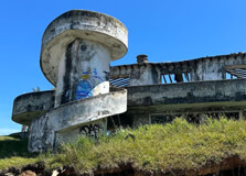
Medellín, Colombia, is a city with a complex and often controversial history, and one of the most infamous figures in that history is Pablo Escobar, the notorious drug kingpin. For decades, Escobar was one of the most powerful and dangerous men in the world, controlling the infamous Medellín Cartel. However, Medellín has gone through a remarkable transformation since his death, moving from a city associated with violence to a vibrant, thriving hub of culture and innovation. Today, Pablo Escobar tours are a unique way to explore the darker chapters of Medellín's past, offering a chance to understand the impact of Escobar's legacy and the city's journey to recovery. These tours provide insight into Escobar's life, his influence, and the places that were once central to his empire. How to Reach Pablo Escobar Tours, Medellín Pablo Escobar tours in Medellín are easily accessible, as many tour companies operate in the city. To get to these tours, the most common starting point is the city center, specifically near the popular Poblado area. From here, you can easily take a taxi, bus, or public transport to the tour departure points. Most tours offer convenient pick-up services directly from your hotel, particularly if you're staying in the Poblado or Laureles neighborhoods. If you're traveling by metro, the closest station to most tours is the “Poblado” metro station. Once there, it's just a short walk to meet the tour groups or the tour operators. Weather at Pablo Escobar Tours, Medellín Medellín’s weather is famously mild and pleasant throughout the year, earning the nickname “The City of Eternal Spring.” The temperatures typically range between 22°C (72°F) and 28°C (82°F). This makes it an ideal destination for year-round tours, including the Pablo Escobar tours. However, the city does experience rain, especially in the afternoon, so it's best to bring an umbrella or a raincoat just in case. The rainy season generally lasts from April to November, while the driest months are from December to March. Whether you visit during the dry or rainy season, the weather is usually comfortable enough for walking tours and outdoor activities. Timing for Pablo Escobar Tours, Medellín Pablo Escobar tours typically run every day, with morning and afternoon options available. Most tours begin between 9:00 AM and 10:00 AM and last around 3 to 4 hours. There are also evening tours, although these are less common. It's essential to check the timing with the tour provider when booking, as times can vary. If you plan to visit popular spots like the "Monaco Building" or "La Catedral," be prepared for a bit of walking, as some of these locations are spread out. Early morning tours tend to be less crowded, giving you a more intimate experience, while afternoon tours may offer better lighting for photography. Why Pablo Escobar Tours, Medellín, are Famous The Pablo Escobar tours are famous for providing a glimpse into the life and criminal empire of one of the most infamous figures in modern history. For many people, Escobar represents a period in Medellín’s history that was marked by violence, drug trafficking, and corruption. These tours delve into Escobar's rise to power, his wealth, and his eventual downfall. They explore locations associated with Escobar’s empire, such as his luxurious home, his private prison, and even the site of his death. The tours offer a chance to reflect on how Medellín has transformed itself since the days when Escobar ruled the city and provide a unique opportunity to learn about the lasting impact of his criminal legacy on Colombia and the world. Entry and Visit Details about Pablo Escobar Tours, Medellín Entry to Pablo Escobar tours is typically through booking with one of the local tour companies that operate in Medellín. The price of a tour usually ranges from $30 to $50 USD per person, depending on the length of the tour and whether it includes any additional stops or features, such as a private guide or special access to locations like Escobar’s family estate. It’s important to note that most tours are conducted in either Spanish or English, so be sure to confirm the language of the tour when booking if you have a preference. In terms of what’s included, the typical tour covers several of Escobar’s former properties, such as his residence in the exclusive neighborhood of El Poblado, his infamous “Monaco Building” apartment complex, and La Catedral, his private prison. Many tours also take visitors to the “Pablo Escobar Grave,” located in the Medellín cemetery, where he was buried after being killed by the Colombian National Police in 1993. History and Architecture of Pablo Escobar Tours, Medellín The history of Pablo Escobar is inextricably tied to the architecture of Medellín, particularly in the 1980s and early 1990s when he was at the peak of his power. Escobar’s influence extended beyond the drug trade and into the city’s infrastructure, where he used his immense wealth to fund various projects, including low-income housing in the city’s poorer neighborhoods. However, his more notorious contributions to the city include the opulent properties he built for himself and his family, many of which are visited during the tours. One of the most significant architectural sites is “La Catedral,” Escobar’s self-built prison located in the mountains outside Medellín. It was designed by Escobar to offer a luxurious lifestyle while serving his sentence, complete with a jacuzzi, soccer field, and even a helicopter pad. It’s a fascinating example of the excess and contradictions in Escobar’s life, serving as a symbol of his power and wealth. Other key architectural locations include the former Monaco Building, where Escobar lived with his family, and several of his other properties scattered throughout the city and surrounding areas. Things to Do During Pablo Escobar Tours, Medellín When you take a Pablo Escobar tour, you will visit several iconic sites that played significant roles in his life and criminal empire. Here are some of the main activities included in most tours: Visit Escobar’s former mansion: Explore the lavish properties that Escobar owned, including his mansion in El Poblado, and learn about how he built his fortune. Monaco Building: This was Escobar’s residence and one of his most iconic properties. The building was bombed in the 1980s, and today, it serves as a reminder of the violence that marked Escobar’s reign. La Catedral: Escobar’s self-built prison, which was more of a luxury resort than a prison. This is one of the most famous spots on the tour. Escobar’s grave: Pay your respects at the grave of Pablo Escobar, located in a cemetery in Medellín. Learn about Medellín’s transformation: Many tours also include a discussion about the transformation of Medellín from a city once known for violence to one of Colombia’s most vibrant and innovative cities today. Facts and Tips about Pablo Escobar Tours, Medellín Fact 1: Pablo Escobar was once one of the richest men in the world, with an estimated net worth of $30 billion at the peak of his power. Fact 2: The Medellín Cartel controlled over 80% of the cocaine entering the United States during the 1980s. Tip 1: Be mindful of your safety. While Medellín is much safer now, it’s always best to travel in groups and be aware of your surroundings. Tip 2: Consider taking a private tour for a more personalized experience and the ability to ask questions about the places you visit. Tip 3: Wear comfortable shoes, as the tours often involve walking through different neighborhoods and locations. In conclusion, Pablo Escobar tours offer an unforgettable way to explore one of the most complex chapters in Medellín’s history. These tours allow visitors to see firsthand the locations that were central to Escobar’s empire, providing insights into the life of a man who shaped Colombia’s past in both positive and negative ways. As Medellín continues to grow and evolve, these tours offer a unique opportunity to reflect on the city’s transformation while understanding the impact of one of the world’s most infamous criminals.
Explore More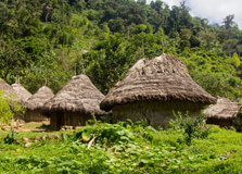
The Lost City (also known as **Ciudad Perdida**) is one of Colombia’s most iconic archaeological sites, located deep in the jungle of the Sierra Nevada mountains near Santa Marta. It is believed to have been founded around 800 AD by the **Tairona people**, long before the arrival of the Spanish conquistadors. The site remained hidden from the outside world until its rediscovery in 1972 by a group of explorers. This ancient city, which was once a thriving hub for the Tairona civilization, is now one of Colombia’s most popular trekking destinations, offering an adventure that combines history, culture, and nature in one unforgettable journey. How to Reach Lost City, Santa Marta Getting to the Lost City is an adventure in itself, as the site is located in the rugged mountains of the Sierra Nevada, approximately 40 kilometers (25 miles) from Santa Marta. The best way to reach the Lost City is by booking a guided trek, as the journey involves hiking through dense jungle, crossing rivers, and navigating steep terrain. There are no direct roads to the Lost City itself, so the trip begins with a drive from Santa Marta to the small village of **Machete Pelao**, which takes about 2-3 hours. From Machete Pelao, visitors then begin their multi-day trek to the Lost City. The trek typically lasts for 4-6 days, depending on the route and pace of the group, and takes hikers through lush tropical forests, remote indigenous villages, and over challenging mountain paths. Guided tours are offered by several tour companies in Santa Marta, and it is strongly recommended to join a tour, as the trails can be difficult to navigate, and hiring a local guide ensures both safety and a deeper understanding of the area’s history and culture. Weather at Lost City, Santa Marta The climate in the Sierra Nevada region is tropical, with hot and humid conditions year-round. However, the temperature can vary significantly depending on the elevation. In the lowland areas, temperatures range from 25°C (77°F) to 30°C (86°F), while the higher altitudes can experience cooler temperatures. During the trek, especially at higher elevations, it’s not uncommon for temperatures to drop at night, so visitors should be prepared with appropriate clothing for varying weather conditions. The rainy season lasts from May to October, with the heaviest rains typically occurring in October and November. During this period, the trails can become muddy and slippery, making the trek more challenging. The dry season, from December to April, is considered the best time to visit, as the trails are more accessible, and the weather is generally sunny and warm. Timing for Lost City, Santa Marta The Lost City trek typically takes between 4 to 6 days to complete, depending on the tour operator and the route taken. Most tours depart from Santa Marta early in the morning, with the trek starting in the afternoon. The first day generally involves a few hours of hiking, with overnight camping in the jungle. The following days consist of longer hikes, with stops at indigenous villages and natural swimming spots along the way. It’s recommended to plan your trek during the dry season, as conditions can be difficult during the rainy months. Due to the remote nature of the Lost City, it’s important to note that the park is closed for maintenance and preservation between the months of **September to mid-December**, so it’s essential to plan accordingly. Why Famous for Lost City, Santa Marta? The Lost City is famous for several reasons, not least of which is its fascinating history. Built by the **Tairona civilization** around 800 AD, it is one of the most significant archaeological sites in Colombia and is often compared to the more famous **Machu Picchu** in Peru due to its ancient origins and breathtaking setting. The city, which includes a network of terraces, plazas, and stone steps, was believed to have been a religious and ceremonial center for the Tairona people, who flourished in this region long before the Spanish arrived. In addition to its cultural significance, the Lost City is also famous for its remote and challenging location. The journey to the city is a multi-day trek through dense jungle and rugged terrain, making it a rewarding experience for adventure seekers. The Lost City remains one of Colombia’s top eco-tourism destinations, offering a blend of history, nature, and physical challenge that attracts both local and international visitors. Entry and Visit Details about Lost City, Santa Marta Entry to the Lost City is only possible with a guided tour, and there are several companies that operate treks from Santa Marta. The entry fee for the trek, which includes the cost of the guide, meals, accommodation, and park entry, varies depending on the tour operator and the length of the trek. Prices typically range from **$300 to $500 USD** per person. The trek begins in **Machete Pelao**, a small village where visitors are briefed on the journey ahead. Along the way, hikers pass through dense jungles, cross rivers, and climb steep hills. Most tours include overnight camping or staying in basic lodges, where hikers can rest and enjoy the beauty of the surrounding environment. It’s also common to take short detours to visit indigenous villages, where you can learn about the customs and traditions of the **Kogi**, **Arhuaco**, and **Wiwas** people, who still live in the Sierra Nevada region. It is important to book the trek in advance, especially during the high season (December to April), as spots can fill up quickly. Tours generally include all meals, snacks, and a guide, but it’s a good idea to bring extra water, sunscreen, insect repellent, and light clothing suitable for the jungle environment. History and Architecture of Lost City, Santa Marta The Lost City was established by the **Tairona** people around 800 AD and is thought to have been a major religious and political center. The city was built on the side of a mountain, with a network of terraces, plazas, and stone stairways connecting the different parts of the site. The architecture is characterized by well-constructed stone walls, pathways, and circular platforms, most of which are still visible today. It is believed that the city was abandoned by the Tairona people in the 16th century due to Spanish colonization, and it remained hidden in the jungle for centuries until its rediscovery in 1972 by a group of treasure hunters. The architecture of the Lost City is a testament to the engineering skills of the Tairona people. The terraces were used for agricultural purposes, and the paths that connect the city’s different sections are still intact. The city is divided into various sectors, with each area having its own distinct function. Some of the key features of the city include the **Great Terrace**, the **Central Plaza**, and the **Sacred Altar**. These elements were used for religious ceremonies and social gatherings, and they give visitors a glimpse into the cultural and spiritual life of the Tairona people. Things to Do at Lost City, Santa Marta While visiting the Lost City is primarily about exploring its ancient ruins, there are plenty of activities to enjoy along the way. Some of the top things to do during your trek to the Lost City include: Hiking: The trek itself is a highlight of the trip. It involves hiking through dense jungle, up and down steep hills, and along rivers. The trail offers stunning views of the surrounding mountains and valleys, and it’s an adventure in itself. Swimming: On the trek, you’ll have the chance to take a dip in refreshing rivers and natural swimming holes, which offer a welcome break from the heat. Visiting Indigenous Villages: Learn about the traditions of the indigenous people of the Sierra Nevada, such as the Kogi, Arhuaco, and Wiwas. You may also have the chance to purchase local handmade crafts. Exploring the Lost City: The main attraction is, of course, the Lost City itself. Wander around the ancient terraces and plazas, and take in the majestic views of the surrounding mountains and jungle. Facts and Tips about Lost City, Santa Marta Fact 1: The Lost City was inhabited for over 600 years before it was abandoned in the 16th century due to Spanish colonization. Fact 2: The trek to the Lost City is about 4 to 6 days long and covers approximately 44 kilometers (27 miles) of jungle terrain. Tip 1: Wear lightweight, moisture-wicking clothes and sturdy hiking boots, as the trek involves long days of walking and steep climbs. Tip 2: Be prepared for the heat and humidity by carrying enough water and using insect repellent to protect yourself from mosquitoes. Tip 3: Don’t forget your camera! The views along the trek and at the Lost City are absolutely stunning, so make sure to capture the experience. The Lost City trek in Santa Marta is one of the most thrilling and rewarding adventures you can experience in Colombia. It offers a rare opportunity to explore an ancient, hidden city while immersing yourself in the beauty of Colombia’s natural landscapes and indigenous culture. Whether you’re a history enthusiast, an adventure seeker, or simply someone looking for an unforgettable journey, the Lost City is a must-see destination.
Explore More
Quinta de San Pedro Alejandrino
Quinta de San Pedro Alejandrino is one of the most iconic and historically significant landmarks in Santa Marta, Colombia. This beautiful colonial estate is famous for being the final residence of **Simón Bolívar**, the South American revolutionary leader who played a central role in the liberation of several Latin American countries from Spanish rule. The estate is now a museum, offering visitors a glimpse into the life of Bolívar, as well as the rich history and culture of the region. Surrounded by lush gardens and historical architecture, Quinta de San Pedro Alejandrino is a must-visit destination for history enthusiasts and tourists alike. How to Reach Quinta de San Pedro Alejandrino, Santa Marta Quinta de San Pedro Alejandrino is conveniently located just 10 minutes by car from the center of Santa Marta. The estate is easily accessible by taxi, public transportation, or private vehicle. If you’re staying in the heart of Santa Marta, you can ask your hotel to arrange a taxi or take a local bus that will drop you near the entrance of the site. The address for Quinta de San Pedro Alejandrino is **Carrera 19 # 10-5**, making it simple to find on a map or navigation app. If you are arriving from the **Simón Bolívar International Airport** in Santa Marta, the estate is approximately a 20-minute drive away, making it a convenient stop after arriving in the city. Alternatively, you can also walk to the location, though it would take about 40 minutes from the city center. Weather at Quinta de San Pedro Alejandrino, Santa Marta Santa Marta, including Quinta de San Pedro Alejandrino, enjoys a tropical climate, with warm temperatures throughout the year. The average temperature typically ranges from **25°C (77°F)** to **30°C (86°F)**. The city is known for its sunny weather, and the estate is no exception. Expect warm, humid days, especially during midday, so be sure to wear light, breathable clothing and carry sunscreen when visiting. The region has a distinct rainy season from May to October, with the heaviest rainfall typically occurring between September and October. While this period can still be a great time to visit due to fewer tourists, be prepared for the possibility of occasional showers. The dry season, from November to April, is considered the best time to visit, as the weather is mostly sunny and perfect for exploring the outdoor areas of Quinta de San Pedro Alejandrino. Timing for Quinta de San Pedro Alejandrino, Santa Marta The museum at Quinta de San Pedro Alejandrino is open daily, typically from **8:00 AM to 5:00 PM**. These hours allow for a full day of exploration, whether you're interested in walking through the gardens, visiting the museum, or learning about the estate’s history. It’s a good idea to arrive early to avoid crowds, especially during the high season, which runs from December to March. While the estate is open throughout the year, it may be busier during weekends and public holidays, so if you're looking for a quieter visit, try to schedule your trip for a weekday morning. Guided tours are available during the day and can be a great way to learn more about the history of the estate and Bolívar’s time here. Why Famous for Quinta de San Pedro Alejandrino, Santa Marta? Quinta de San Pedro Alejandrino is famous for its historical significance as the final resting place of Simón Bolívar. Bolívar arrived at the estate in 1830, in the midst of his battle with tuberculosis, and he passed away there on **December 17, 1830**. Today, the estate stands as a monument to his life and legacy, offering an intimate look at the final days of one of South America’s most important historical figures. In addition to its historical importance, the Quinta is also renowned for its beautiful colonial architecture and lush surroundings. The estate’s expansive gardens, where Bolívar spent his last days, provide a tranquil atmosphere, offering visitors a peaceful retreat from the busy city. The estate also houses a museum that showcases Bolívar’s life, his role in Latin American independence, and the historical significance of the region. Entry and Visit Details about Quinta de San Pedro Alejandrino, Santa Marta Entry to Quinta de San Pedro Alejandrino is generally affordable. The entrance fee is approximately **10,000 to 20,000 Colombian pesos** (around $3 to $6 USD), making it an accessible and budget-friendly attraction for most travelers. The entry fee grants visitors access to the museum, the gardens, and the Bolívar monument. Special tours are available for an additional fee, and these can be arranged on-site or through tour operators in Santa Marta. Once you arrive, you can explore the museum at your own pace or choose to take a guided tour. The museum offers exhibitions about Bolívar’s life, his time in Santa Marta, and his role in the independence of several Latin American nations. The estate also features a **reconstruction of Bolívar’s death room**, which adds to the historical atmosphere of the site. History and Architecture of Quinta de San Pedro Alejandrino The estate was originally built in the 17th century, though it was later expanded and renovated. Quinta de San Pedro Alejandrino was used as a plantation and estate for many years, but its most important historical role came in 1830 when Simón Bolívar sought refuge here during his final days. Bolívar’s arrival in Santa Marta was in part due to his deteriorating health, as he was suffering from tuberculosis at the time. While at Quinta de San Pedro Alejandrino, Bolívar spent his last days in relative seclusion. The estate’s architecture reflects a blend of colonial and local styles, with wide, airy rooms, high ceilings, and an open courtyard that leads out to lush gardens. The main house, where Bolívar passed away, remains a central part of the estate, and its interiors have been preserved to reflect the historical period of Bolívar’s time there. Things to Do at Quinta de San Pedro Alejandrino Visiting Quinta de San Pedro Alejandrino offers a range of activities for history buffs, nature lovers, and anyone interested in Colombian culture: Explore the Museum: Learn about the life and legacy of Simón Bolívar through informative exhibits, artifacts, and the restored rooms of his final residence. Wander the Gardens: The estate’s expansive gardens are perfect for a leisurely walk. Visitors can enjoy the serene surroundings while admiring local plant species and the stunning landscapes of the Sierra Nevada mountains. Visit the Bolívar Monument: Pay tribute to the great leader at the Bolívar monument located on the grounds, a fitting tribute to the man who fought for the independence of several Latin American countries. Guided Tours: Take a guided tour to learn about Bolívar’s life, the estate’s history, and the surrounding area. A local guide will offer insights that enrich your understanding of the site. Photography: The beautiful architecture, gardens, and historical elements of Quinta de San Pedro Alejandrino make it a great location for photography. Facts and Tips about Quinta de San Pedro Alejandrino Fact 1: Quinta de San Pedro Alejandrino is considered a national monument of Colombia and is protected by the Colombian government as an important historical site. Fact 2: The estate’s gardens are home to various species of tropical plants, including fruit trees, flowering plants, and ornamental species. Tip 1: Be sure to bring comfortable shoes for walking through the estate, especially if you plan to explore the gardens and grounds. Tip 2: If visiting during the rainy season, carry an umbrella or rain jacket to stay dry, as the weather can be unpredictable at times. Tip 3: Allow yourself at least 1-2 hours to fully explore the estate and museum, especially if you want to take a guided tour. Quinta de San Pedro Alejandrino is an essential stop for those interested in Colombian history, particularly the life of Simón Bolívar. With its beautiful gardens, historical buildings, and informative exhibits, it offers a unique opportunity to step back in time and learn about one of the most influential figures in Latin American history. Whether you're a history lover, a nature enthusiast, or simply curious about Colombia’s past, a visit to Quinta de San Pedro Alejandrino is sure to be a memorable experience.
Explore More
The **Cali Zoo** (Zoológico de Cali) is one of Colombia’s most renowned zoos, located in the vibrant city of Cali, Valle del Cauca. As one of the oldest zoos in the country, it offers visitors a chance to explore a rich diversity of wildlife, from native Colombian species to animals from around the world. The zoo’s primary goal is conservation, offering an educational and family-friendly experience. Whether you’re an animal lover, a nature enthusiast, or simply looking for a fun way to spend the day, the Cali Zoo has something to offer for everyone. How to Reach Cali Zoo, Cali Located just a few kilometers from the city center, getting to **Cali Zoo** is relatively easy, whether you're traveling by car, public transportation, or taxi. The zoo is situated in the **Valle del Lili** area, in the southern part of Cali. If you're using public transportation, you can take a bus to the zoo, or opt for a taxi which is both quick and convenient. For those driving, the zoo has ample parking space, making it accessible for visitors with cars. It’s also relatively close to the **Cali River**, making it easy to combine your zoo visit with a trip to the nearby parks or riverbanks. Weather at Cali Zoo, Cali Cali enjoys a tropical climate, with warm temperatures throughout the year. The average temperature in Cali ranges from 24°C to 28°C (75°F to 82°F), which makes it a comfortable destination for most of the year. However, the rainy season usually runs from April to November, so it's advisable to check the forecast and bring an umbrella or raincoat if you plan to visit during those months. The dry season, from December to March, is perfect for exploring the zoo, as the weather is sunny and pleasant. It’s a great time to enjoy outdoor activities at the zoo and other attractions in Cali. Timing at Cali Zoo, Cali The zoo is open every day of the week, from **9:00 AM to 5:00 PM**. These extended hours make it possible for visitors to plan their day according to their schedule. However, it’s worth noting that weekends tend to be busier, especially during peak tourist seasons, so if you prefer a more tranquil experience, visiting on a weekday might be a better option. Keep in mind that the zoo’s restaurant and gift shop may have different hours of operation, so it’s best to check ahead if you have specific plans to visit those areas. Why Famous for Cali Zoo, Cali? The **Cali Zoo** is famous for its diverse collection of animals, many of which are native to Colombia and the surrounding regions. The zoo specializes in the conservation of endangered species, particularly those from the Colombian Andes and the Amazon rainforest. It is considered one of the top zoos in the country because of its focus on environmental education, conservation programs, and its role in scientific research. The zoo is also well-known for its lush, naturalistic enclosures, which mimic the animals’ natural habitats as closely as possible. This ensures that both the animals and visitors have a positive experience during their time at the zoo. Entry and Visit Details about Cali Zoo, Cali Visitors can purchase tickets at the zoo entrance, where there are both general admission and special rates for children, students, and seniors. As of recent years, the general entry fee is about 22,000 COP (roughly $6 USD), with discounts for students and children under 12 years old. It's always a good idea to bring some cash, as not all areas of the zoo may accept cards. The zoo also offers group discounts for school and tour groups, and it's a great option for educational field trips. Upon entering the zoo, guests are provided with a map, which is handy for navigating the expansive grounds. The zoo has several themed areas, such as the Amazonian section, which showcases the flora and fauna of the Amazon rainforest, and the Andean zone, which highlights animals from Colombia’s mountain regions. Visitors can also enjoy the “African Savannah,” which features species like giraffes and zebras. It’s a large zoo, so comfortable walking shoes are recommended. History and Architecture of Cali Zoo The **Cali Zoo** was founded in 1969 with the aim of educating the public about wildlife and conservation. Over the years, it has evolved into a top-tier zoo that is recognized for its contributions to conservation efforts in Colombia. Originally, the zoo housed mostly local species, but as the zoo grew, it began to diversify its collection to include animals from all over the world. The zoo’s architecture is designed to integrate the natural surroundings, with large open spaces and enclosures designed to give the animals as much freedom as possible while still keeping them safe. The design focuses on ecological sustainability, ensuring that the zoo functions in harmony with the surrounding environment. Things to Do at Cali Zoo Aside from enjoying the impressive animal exhibits, there are plenty of activities to keep visitors entertained. One of the highlights of a visit to the zoo is the **educational talks** and animal feeding times, where guests can learn about the behaviors and habitats of the animals. The zoo also offers guided tours, which provide a deeper understanding of the species on display and their conservation statuses. Children will enjoy the **playgrounds** located throughout the zoo, where they can take a break from walking and have fun. In addition, there are several **picnic areas**, perfect for relaxing and enjoying the beautiful natural surroundings. Facts about Cali Zoo The zoo covers 2.7 hectares of land and is home to more than 1,200 animals. It houses over 100 species of birds, reptiles, mammals, and amphibians. The Cali Zoo is involved in breeding programs for endangered species, such as the **Andean bear** and the **Amazon river dolphin**. It has received recognition for its educational programs, which aim to raise awareness about wildlife conservation and the importance of protecting natural habitats. Tips for Visiting Cali Zoo Wear comfortable shoes, as the zoo requires a lot of walking. Bring sunscreen, a hat, and water, especially if visiting during the sunny, dry months. Check for any special events or animal shows before your visit to make the most of your time. If you have young children, bring along a stroller, as the zoo can be large and tiring for little ones. Arrive early to avoid the crowds, especially on weekends and during peak tourist seasons. Visit the zoo’s educational center to learn about ongoing conservation efforts and how you can get involved in protecting endangered species. Conclusion The **Cali Zoo** is a wonderful place for anyone looking to experience the beauty of Colombia’s wildlife. Whether you're an animal lover, a family on vacation, or a traveler interested in conservation, the zoo offers a fun and educational experience. With its wide range of species, lush green spaces, and dedication to animal welfare, it stands out as one of the top attractions in Cali. Be sure to include it in your itinerary when visiting this vibrant Colombian city.
Explore More
**Cristo Rey** is one of the most iconic landmarks in **Cali**, Colombia. Perched on a hill overlooking the city, this massive statue of Christ the King offers not only a spiritual experience but also a breathtaking view of Cali and its surrounding mountains. It is a popular destination for both locals and tourists, attracting thousands of visitors every year due to its historical, cultural, and scenic significance. How to Reach Cristo Rey, Cali Getting to **Cristo Rey** is relatively easy, and it can be done by several means of transportation. The site is located on **Cerro de Cristo Rey**, a hill in the southern part of Cali, offering stunning views of the city and the surrounding valley. From the city center, it’s approximately a 30-minute drive, depending on traffic. You can take a taxi or drive yourself, as there are parking facilities available near the monument. Alternatively, public buses also serve the area, but the taxi or private vehicle option is more convenient for those who prefer a direct route. For those feeling more adventurous, there is a hiking trail that leads to the top of the hill, making it a great option for nature lovers. The trail takes about 45 minutes to an hour to ascend, depending on your pace. It’s a scenic route, allowing visitors to enjoy the lush greenery and cool breeze as they make their way up to the top. Weather at Cristo Rey, Cali Cali has a tropical climate, with warm temperatures year-round, averaging between 24°C and 28°C (75°F to 82°F). The city enjoys sunny days, with occasional rain during the wet season, which typically lasts from April to November. When visiting **Cristo Rey**, it’s essential to consider the weather, as the hill can be quite warm during the dry season. If you're planning to hike, make sure to wear sunscreen, a hat, and comfortable clothing. During the rainy season, it's advisable to check the weather forecast before your trip to avoid heavy downpours, which could make the trail slippery and more challenging to navigate. Timing at Cristo Rey, Cali The **Cristo Rey** monument is accessible every day of the week, and the best time to visit is during the day for clear views of the city. While the monument itself doesn’t have set opening hours, most visitors tend to arrive between 9:00 AM and 5:00 PM. If you're interested in seeing the city at its most beautiful, consider visiting at sunrise or sunset. The view of the city illuminated by the soft golden light during these times is absolutely stunning and offers a peaceful atmosphere for reflection and sightseeing. Why Famous for Cristo Rey, Cali? **Cristo Rey** is famous for its imposing statue of Christ the King, which stands at 26 meters tall (about 85 feet). The statue was completed in 1953 and has become one of the most recognizable symbols of Cali. It’s often compared to the famous Christ the Redeemer statue in Rio de Janeiro due to its similar design and location atop a hill, offering panoramic views of the surrounding area. Aside from its religious significance, **Cristo Rey** is also well-known for the spectacular views it offers. From the top, visitors can enjoy an unobstructed view of the entire city of Cali, including the Cauca River and the surrounding mountains. This makes it a popular spot for photography, sightseeing, and simply appreciating the beauty of the region. Entry and Visit Details about Cristo Rey, Cali There is no formal entry fee to visit **Cristo Rey**, making it an accessible destination for all. Visitors are free to explore the monument and the surrounding area without any restrictions. However, if you plan to hike up the hill, you may need to pay a small fee to access the designated trailhead, as well as for parking if you're driving. Upon arrival, you can admire the majestic statue and take a moment to reflect at the base of the monument. For those interested in the surrounding area, there are small souvenir stands and vendors offering snacks and drinks, making it a great spot to relax after your hike or drive to the top. History and Architecture of Cristo Rey, Cali The construction of the **Cristo Rey** statue was part of a broader effort to create a spiritual and cultural landmark in Cali. The statue was designed by the sculptor **Gabriel Restrepo** and was inaugurated in 1953. The monument is made of concrete and stands on a sturdy base, which also serves as a viewing platform for visitors. The statue is unique for its outstretched arms, symbolizing Christ’s embrace of the world. The surrounding area has been developed with gardens, pathways, and places for reflection, enhancing the visitor experience. Architecturally, **Cristo Rey** is a monumental piece of religious art, and it plays an important role in the religious life of the city. The site is frequently used for religious ceremonies, including mass celebrations and processions, especially during important Catholic holidays. The surrounding park area also makes the location an ideal spot for peaceful walks and moments of contemplation. Things to Do at Cristo Rey, Cali There’s plenty to do when visiting **Cristo Rey**, whether you’re looking for spiritual reflection, scenic views, or outdoor activities. Some of the top things to do include: Enjoy the View: The primary reason to visit **Cristo Rey** is to take in the breathtaking panoramic views of Cali and the surrounding mountains. Be sure to take your time and capture some beautiful photographs. Hike the Trail: For those seeking a more active experience, the hike up the hill offers a great opportunity to connect with nature and enjoy the fresh air. It’s a short but rewarding trek, with stunning scenery along the way. Relax and Reflect: The peaceful atmosphere at the top of the hill makes it an ideal location for personal reflection, prayer, or simply enjoying the tranquility of the area. Visit Nearby ��Ӱֱ��: After visiting **Cristo Rey**, you can explore nearby attractions, including the **Parque Nacional de los Farallones de Cali** or take a stroll along the **Cali River**. Facts About Cristo Rey, Cali The **Cristo Rey** statue stands 26 meters (85 feet) tall, making it one of the tallest Christ statues in Colombia. The monument was inaugurated in 1953 and was constructed as a symbol of faith and devotion for the people of Cali. The hill on which the statue stands is called **Cerro de Cristo Rey**, offering a panoramic view of the city below. The statue is part of a larger park that includes walking trails, gardens, and observation platforms. Every year, during religious holidays, the hill hosts various spiritual events, including masses and processions. Tips for Visiting Cristo Rey, Cali Wear comfortable shoes if you plan on hiking to the top, as the trail can be steep in parts. Bring sunscreen, especially if visiting during the hot months, as the sun can be intense at the top. If you’re visiting during the wet season, carry an umbrella or a raincoat, as the weather can change suddenly. Consider visiting early in the morning or later in the afternoon to avoid crowds and enjoy the best views of the city. Take time to explore the surrounding area, including the nearby gardens and walking paths. Conclusion **Cristo Rey** in Cali is more than just a monument; it’s a place of spiritual significance, historical value, and natural beauty. Whether you’re visiting for religious reasons, enjoying the stunning panoramic views, or simply taking in the cultural atmosphere, it’s a must-see attraction in Cali. With its easy accessibility, stunning scenery, and peaceful surroundings, **Cristo Rey** is a highlight of the city and a great destination for visitors of all kinds.
Explore More
**Cerro de las Tres Cruces** (Hill of the Three Crosses) is one of the most iconic natural landmarks in **Cali**, Colombia. Offering stunning panoramic views of the city, the hill is a popular spot for both locals and tourists looking for an outdoor adventure and a taste of Cali’s natural beauty. The hike to the top of **Cerro de las Tres Cruces** not only offers incredible views but also provides visitors with a glimpse into the cultural and historical significance of this location. How to Reach Cerro de las Tres Cruces, Cali **Cerro de las Tres Cruces** is located in the **Southwest** of Cali, just a short distance from the city center. It’s easily accessible by car, taxi, or public transportation, and visitors often combine a visit with a trip to the nearby **Cerro de la Palmera** for more stunning views of the city. If you're traveling by car, the most direct route is to head toward the **Cali River** and then follow the road signs leading to the entrance of the hill. From there, visitors can either hike up or drive to the base of the hill and start their ascent. Alternatively, you can take a taxi or an Uber directly to the base of the hill. For those relying on public transportation, there are several bus routes that pass near the base of **Cerro de las Tres Cruces**, and local taxi services are readily available throughout the city. Walking or hiking from the city center is also an option, but it requires more time and physical effort. Weather at Cerro de las Tres Cruces, Cali **Cali** enjoys a tropical climate with warm temperatures year-round. The weather in **Cerro de las Tres Cruces** is no different, with temperatures ranging from 24°C to 30°C (75°F to 86°F) throughout the year. The best time to visit the hill is during the dry season, from December to March, as this period offers clearer skies and better visibility from the top of the hill. However, if you don’t mind a bit of rain, you can still visit during the wet season (April to November), though be prepared for occasional showers and muddy paths. The altitude of the hill also provides a bit of a cooler breeze compared to the city below, making the climb a refreshing experience, especially in the early morning or late afternoon when temperatures are lower. Timing at Cerro de las Tres Cruces, Cali The hill is open for visitors at all hours, but most people prefer to visit during daylight hours for safety reasons. The **hiking trail** to the top of **Cerro de las Tres Cruces** typically takes between 30 minutes to an hour, depending on your pace and fitness level. If you're planning to enjoy the view or take photos, it’s recommended to visit early in the morning or later in the afternoon. These times offer softer sunlight and allow for beautiful photographs of the surrounding city and natural scenery. Why Famous for Cerro de las Tres Cruces, Cali? **Cerro de las Tres Cruces** is famous for its incredible panoramic views of **Cali** and its historical significance. The three large crosses that stand at the top of the hill are the main focal point of the attraction and are believed to be a symbol of the Catholic faith in the region. The crosses were erected as part of a religious tradition, and they now serve as a landmark for those trekking to the top of the hill. Aside from the crosses, the hill’s height and position provide visitors with breathtaking views of the **Cali Valley**, the **Pacific foothills**, and the nearby **Cali River**. On clear days, you can see the entire city, including other notable landmarks like the **Cali Tower**, **Cristo Rey**, and the **Cali Zoo**. The hill also provides a great vantage point to watch the sunset over the city, adding to its appeal as a popular hiking destination. Entry and Visit Details about Cerro de las Tres Cruces, Cali Visiting **Cerro de las Tres Cruces** is completely free, making it an accessible activity for both locals and tourists alike. There is no official entrance fee, and visitors can explore the site at their own pace. However, it’s important to note that the hill’s surroundings can be steep and challenging, so it’s advisable to wear appropriate footwear, especially if you plan to hike to the top. Many people take the **hiking trail** that leads to the summit, which takes around 30 to 45 minutes to complete. The path can be a bit strenuous, so it's important to bring water, wear sunscreen, and take breaks as needed. The trail is well-marked, but it’s recommended to visit during the day for safety. While the area is generally safe, it's a good idea to go with a group or a guide, especially if you're unfamiliar with the terrain. History and Architecture of Cerro de las Tres Cruces, Cali
Explore More
Casa del Carnaval, also known as the Carnival House, is one of the most important cultural landmarks in Barranquilla, Colombia. It serves as a museum and cultural center dedicated to the world-famous Barranquilla Carnival, one of the biggest and most vibrant carnivals in Latin America. Located in the heart of the city, Casa del Carnaval is a place where visitors can learn about the history, traditions, costumes, and music that make the Carnival so special. It is an essential stop for anyone who wants to understand the spirit and identity of Barranquilla. How to Reach Casa del Carnaval, Barranquilla Casa del Carnaval is located in the city of Barranquilla in northern Colombia. It is situated at Carrera 54 #49B-39, a central area that is easily accessible by various modes of transport. If you are arriving by air, you will land at Ernesto Cortissoz International Airport, which is around 45 minutes from the city center by taxi or car. You can hire a taxi, use a ride-sharing app, or rent a car to reach the museum. Public transportation like buses and minibuses are also available and inexpensive, but they might be confusing for tourists who are not familiar with the routes. Weather in Barranquilla Barranquilla has a tropical climate. The city remains hot and humid for most of the year. Average temperatures range from 25°C to 32°C (77°F to 90°F). The dry season usually lasts from December to April, which is considered the best time to visit. The Carnival takes place in February or March, during the dry season, making it a perfect time to explore Casa del Carnaval. Timings of Casa del Carnaval Casa del Carnaval is generally open from Monday to Friday, from 9:00 AM to 5:00 PM. On Saturdays, it may have reduced hours, and it is usually closed on Sundays and public holidays. It’s always a good idea to check the official website or call ahead before planning your visit to confirm the current hours. Why Casa del Carnaval is Famous Casa del Carnaval is famous because it is the main cultural center dedicated to the Barranquilla Carnival, which is recognized by UNESCO as a Masterpiece of the Oral and Intangible Heritage of Humanity. The museum captures the essence of this festival with colorful exhibits, vibrant costumes, musical instruments, traditional masks, and interactive displays. It provides an immersive experience of one of Colombia’s most important cultural events. Entry and Visit Details The entrance fee to Casa del Carnaval is modest, making it accessible to most visitors. General admission is typically around 5,000 to 10,000 Colombian pesos (about $1.50 to $3 USD), and there may be discounts for students, children, and seniors. Guided tours are also available for an additional cost, and they are highly recommended if you want in-depth information about the exhibits. The museum is wheelchair accessible and has friendly staff to assist visitors. Most of the displays have explanations in both Spanish and English, making it easy for international tourists to understand. History and Architecture of Casa del Carnaval Casa del Carnaval is housed in a colonial-style building that blends traditional and modern architecture. The structure has been beautifully restored to maintain its historical charm while serving modern functions. It was officially opened as a cultural center in 2000 and has since become a symbol of Barranquilla’s cultural pride. The architecture reflects the festive spirit of the Carnival, with bright colors, murals, and decorations that mirror the creativity seen during the festival. The interior is well-designed with various exhibition halls, a library, a media room, and a terrace that is sometimes used for live performances and events. Things to Do at Casa del Carnaval There are plenty of things to see and do at Casa del Carnaval: Explore exhibitions showcasing the history and evolution of the Carnival. View traditional costumes worn by dancers and performers over the years. Learn about the various cultural characters such as Marimonda, Garabato, and Congo. Watch video documentaries and multimedia presentations about the festival. Participate in cultural workshops and art activities when available. Shop for Carnival-themed souvenirs and crafts in the gift shop. Interesting Facts about Casa del Carnaval Here are some fun and interesting facts about Casa del Carnaval: It is managed by the Carnival of Barranquilla Foundation, which also organizes the annual Carnival event. The museum is a hub for artists, dancers, and musicians throughout the year. Every year, it becomes a central point for Carnival activities, press conferences, and performances. It has a large archive of Carnival-related materials, including photos, music, videos, and documents. Tips for Visiting Casa del Carnaval Here are some useful tips to make the most of your visit: Visit during the Carnival season (February-March) to experience the festive vibe and events nearby. Wear comfortable clothes and stay hydrated, as Barranquilla can be hot and humid. Take a guided tour to understand the deeper meaning behind the displays and characters. Don’t forget to bring a camera – the colorful exhibits are great for photos. Combine your visit with a walk through Barranquilla’s historic downtown for a full cultural experience. Casa del Carnaval is more than just a museum – it is a celebration of life, culture, and identity in Barranquilla. Whether you’re a history lover, art enthusiast, or just a curious traveler, this place offers a vibrant and educational experience you won’t forget.
Explore More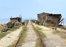
Bocas de Ceniza, which translates to “Mouth of Ashes,” is a fascinating natural and man-made marvel located at the meeting point of the Magdalena River and the Caribbean Sea in Barranquilla, Colombia. This unique location marks the mouth of Colombia’s largest river and is known for its striking natural beauty, history, and importance to maritime activity. It's one of the most picturesque and historically rich areas in the region, drawing both locals and tourists who are eager to explore its wonders. How to Reach Bocas de Ceniza, Barranquilla Reaching Bocas de Ceniza is an adventure in itself. It is not accessible by regular roadways, but rather by a historic rail system known locally as the “tren de Bocas de Ceniza.” Visitors can take this small, open-air rail cart, operated by locals, from Las Flores neighborhood in Barranquilla. The ride travels along a narrow embankment called the Tajamar, built to guide the flow of the Magdalena River into the sea. Another way to get close to the site is by boat. Some tour operators offer guided boat tours from the riverbank that provide a scenic and informative route to Bocas de Ceniza. It's recommended to book these tours in advance, especially on weekends or holidays when visitor numbers increase. Weather in Bocas de Ceniza, Barranquilla Bocas de Ceniza experiences a tropical climate, typical of the Caribbean coast. The weather is generally hot and humid throughout the year. Temperatures typically range between 28°C and 34°C (82°F to 93°F). The dry season, from December to April, is the best time to visit as there is less rainfall and clearer skies. The rainy season, which runs from May to November, may bring heavy showers, especially in the afternoons, but it usually doesn’t last long. Timings There are no fixed hours of operation for Bocas de Ceniza since it is a natural site, but visits are typically recommended during daylight hours, from around 8:00 AM to 5:00 PM. The rail carts and boats usually run during these times. It's not advisable to visit in the late evening or night due to limited lighting and safety concerns. Why is Bocas de Ceniza Famous? Bocas de Ceniza is famous for its unique geographical location where the mighty Magdalena River meets the Caribbean Sea. This creates dramatic views of swirling water, shifting tides, and strong currents. It’s also known for the artificial jetties, or "tajamares", which were constructed to help guide the river’s flow and improve navigation. The long stone embankments stretch into the sea, offering breathtaking views and a sense of walking on water. The area is also recognized for its biodiversity, particularly bird species, making it a favorite among bird watchers and nature photographers. In addition, it holds cultural and historical importance for the people of Barranquilla, symbolizing the city’s connection to both river and sea. Entry and Visit Details There is no official entry fee for visiting Bocas de Ceniza, but you may need to pay for the rail cart ride or a boat trip. The rail ride typically costs between 5,000 to 10,000 Colombian pesos (around $1.50 to $3 USD), depending on the season and whether it’s a weekday or weekend. No special permits are required, and guided tours are optional but helpful for those who want to learn about the area’s history and ecology. It is advisable to bring water, sun protection, and wear comfortable shoes for walking. History and Architecture Bocas de Ceniza has a fascinating history. In the early 20th century, navigating the mouth of the Magdalena River was extremely difficult due to the shifting sediments and strong currents. To solve this problem, an ambitious engineering project was launched in the 1930s under the guidance of Cuban engineer Francisco Javier Cisneros. The solution was to build stone jetties — long, narrow embankments that would direct the river’s flow more efficiently into the sea. These structures, known as the Tajamares, extend for several kilometers and are considered a marvel of civil engineering for the time. They not only helped control the flow of the river but also allowed the development of Barranquilla as a major port city. Things to Do in Bocas de Ceniza Ride the Tren de Bocas de Ceniza: Enjoy the scenic ride on the small rail carts that take you along the narrow embankment to the mouth of the river. Bird Watching: The area is rich in birdlife, offering sightings of pelicans, herons, and other species. Photography: Capture stunning views of the ocean, river, and jetties — especially during sunrise or sunset. Fishing: Many locals fish in the area, and you may try your hand or simply watch the skilled fishermen. Walking the Tajamares: For the adventurous, walking along the stone jetties can be a memorable and meditative experience, though caution is advised. Interesting Facts and Tips about Bocas de Ceniza, Barranquilla The name “Bocas de Ceniza” comes from the grayish color of the water where the river meets the sea, resembling ash. The Tajamares were one of the biggest civil engineering projects in Colombia during the early 20th century. Safety Tip: Be cautious while walking on the embankments, especially during high tides or rainy days as the rocks can be slippery. Local Tip: Go early in the morning to avoid the midday heat and catch the best views. Bring essentials: Water, sunscreen, sunglasses, and a hat are recommended as there is little to no shade. Support locals: Buying snacks or crafts from vendors in the Las Flores area helps support the community. Bocas de Ceniza is a hidden gem that combines nature, history, and adventure in one destination. Whether you're a photographer, a history lover, or simply seeking a peaceful spot away from the city, this place offers something special. It's a must-see if you're visiting Barranquilla and want to connect with the unique geographical and cultural features of the region.
Explore More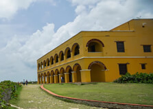
Castillo de Salgar is a beautiful historical site located near Barranquilla, Colombia. Sitting on a cliff overlooking the Caribbean Sea, this old fort offers breathtaking ocean views and a chance to step back in time. It is one of the most popular landmarks in the region, attracting tourists, photographers, and history lovers from all over the world. How to Reach Castillo de Salgar, Barranquilla Castillo de Salgar is located about 20 kilometers from Barranquilla in the town of Salgar. The easiest way to reach it is by car or taxi. It takes approximately 30–40 minutes to get there from central Barranquilla. If you are staying in Barranquilla, many local tour companies also offer day trips to the castle. Public transportation like buses or shared vans may also be available from Barranquilla to Puerto Colombia, and from there, you can take a short ride to Salgar. However, using a private vehicle or taxi is recommended for convenience. Weather at Castillo de Salgar, Barranquilla The weather around Castillo de Salgar is typically warm and tropical. Average temperatures range between 25°C (77°F) and 32°C (89°F) throughout the year. The dry season runs from December to April, which is the best time to visit. The rainy season is from May to November, but even during this time, rain usually comes in short bursts. Visitors are advised to carry sunscreen, sunglasses, and hats to protect themselves from the strong Caribbean sun. Timings of Castillo de Salgar, Barranquilla Castillo de Salgar is generally open to visitors from Tuesday to Sunday, between 10:00 AM and 6:00 PM. However, these hours may vary slightly depending on events or maintenance schedules. It is closed on Mondays. It is a good idea to check ahead by contacting the venue or visiting their official website or social media pages for the latest updates on timings and availability. Why is Castillo de Salgar Famous? Castillo de Salgar is famous for several reasons. Firstly, it has historical significance as a colonial fort built in the 19th century. Secondly, its stunning cliffside location offers panoramic views of the Caribbean Sea, making it a favorite spot for photography and sunset watching. The castle is also a popular venue for weddings, cultural events, and music concerts. Its unique setting and historical atmosphere make it a memorable location for celebrations and gatherings. Entry and Visit Details Entry to Castillo de Salgar is usually free for casual visitors who want to explore the exterior and enjoy the view. However, some parts of the fort may be closed during private events. Guided tours may be available for a small fee if you want to learn more about the history and architecture. There is a restaurant and bar inside the fort where visitors can enjoy local Colombian cuisine and drinks while watching the sunset. There are also clean restrooms and parking facilities available nearby. History and Architecture of Castillo de Salgar The Castillo de Salgar was originally built in 1848 by the Spanish to serve as a military fort and customs house. Its strategic location on the coast allowed it to monitor ships entering the nearby port. Over the years, the fort has been restored and preserved to maintain its historical charm. The architecture is colonial with thick stone walls, arched doorways, and open courtyards. Its yellow exterior stands out against the blue sea and sky, making it an iconic structure in the region. The fort has been carefully restored to keep its original style while adding modern touches like lighting and seating for visitors. Things to Do at Castillo de Salgar There are many activities you can enjoy at Castillo de Salgar: Take a guided tour to learn about the fort’s history. Enjoy a meal or drink at the restaurant inside the fort. Watch the beautiful sunset over the Caribbean Sea. Take photos of the stunning ocean views and historic structure. Attend a cultural event, wedding, or music performance if available. Relax and enjoy the ocean breeze while walking around the area. Interesting Facts and Tips The fort was originally built to support the customs operations for incoming and outgoing ships during colonial times. Its design helped protect the coast from pirates and foreign invasions. The fort has been used as a restaurant, museum, and event venue over the years. It is a favorite spot for local wedding photographers and drone shots. Visiting around sunset is highly recommended for the best lighting and views. Tips for Visitors: Try to visit during weekdays to avoid weekend crowds. Wear comfortable shoes as you’ll walk on uneven surfaces. Bring a camera or smartphone with good storage—there are lots of photo opportunities! If you’re driving, try to arrive early to find parking nearby. Plan to spend at least 1–2 hours to fully enjoy the experience. Conclusion Castillo de Salgar is a perfect blend of history, culture, and natural beauty. Whether you’re a history lover, a romantic couple looking for a scenic spot, or just someone who enjoys beautiful views, this castle near Barranquilla is well worth the visit. Its peaceful environment and historical charm offer a unique experience that reflects Colombia’s rich coastal heritage.
Explore More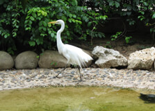
The Barranquilla Zoo, officially known as Zoológico de Barranquilla, is a prominent zoological park located in the city of Barranquilla, Colombia. ��Ӱֱ�� to over 700 animals representing approximately 130 species, the zoo offers visitors an opportunity to observe a diverse range of wildlife, including native Colombian species and exotic animals from around the world. :contentReference[oaicite:2]{index=2} How to Reach Barranquilla Zoo Situated in the La Concepción neighborhood of Barranquilla, the zoo is easily accessible by various modes of transportation. Visitors can take local buses, taxis, or drive to the location. The zoo's central location within the city makes it a convenient destination for both locals and tourists. Weather Barranquilla experiences a tropical climate, characterized by warm temperatures and high humidity throughout the year. Average temperatures range from 25°C to 32°C (77°F to 90°F). The dry season typically spans from December to April, while the rainy season occurs from May to November. Visitors are advised to wear light clothing, stay hydrated, and use sun protection when visiting the zoo. Timings The Barranquilla Zoo is open to the public daily. While specific opening hours may vary, it is generally advisable to visit during daylight hours, typically from 9:00 AM to 5:00 PM. It's recommended to check the official website or contact the zoo directly for the most up-to-date information on operating hours. Why is Barranquilla Zoo Famous? The Barranquilla Zoo is renowned for its commitment to wildlife conservation, education, and providing a safe haven for animals rescued from illegal trafficking. It serves as a vital center for environmental education, aiming to raise awareness about the importance of biodiversity and the protection of endangered species. The zoo's efforts in rehabilitating and caring for animals have made it a respected institution in Colombia. Entry and Visit Details As of the latest available information, the entrance fee for adults and children is approximately COP 25,000. Children under 80 cm in height may enter for free. The zoo offers various amenities, including guided tours, educational programs, and interactive exhibits. Visitors can enjoy observing a wide array of animals, participate in feeding sessions, and learn about conservation efforts. :contentReference[oaicite:37]{index=37} History and Architecture The origins of the Barranquilla Zoo date back to the 1930s, with its official inauguration occurring in February 1953. Initially established as a park-vivero, the zoo has undergone several transformations over the decades. In the 1960s and 1970s, the zoo expanded its collection through exchanges with international zoos. In the 1990s, the administration of the zoo was transferred to the Fundación Botánica y Zoológica de Barranquilla, which continues to oversee its operations. :contentReference[oaicite:46]{index=46} Things to Do Visitors to the Barranquilla Zoo can engage in a variety of activities: Observe a diverse range of animals, including mammals, birds, reptiles, and amphibians. Participate in educational programs and workshops focused on wildlife conservation. Enjoy interactive exhibits and feeding sessions with certain animals. Relax in designated picnic areas and green spaces within the zoo. Visit the on-site museum and library to learn more about natural history and biodiversity. Facts and Tips The zoo houses notable species such as the African elephant, white tiger, spectacled bear, and manatee. It serves as a rehabilitation center for animals rescued from illegal trafficking. The zoo emphasizes environmental education and offers programs for schools and community groups. Visitors are encouraged to wear comfortable clothing and footwear suitable for walking. It's advisable to bring water, sun protection, and insect repellent when visiting.
Explore More
Museo Romántico, located in the historic El Prado neighborhood of Barranquilla, Colombia, is a charming museum dedicated to preserving and showcasing the romantic and cultural heritage of the city. Housed in a beautifully restored early 20th-century mansion, the museum offers visitors a glimpse into the elegant lifestyle and artistic expressions of Barranquilla's past.:contentReference[oaicite:4]{index=4} How to Reach Museo Romántico Museo Romántico is situated at Carrera 54 #59-199 in the El Prado district of Barranquilla. To reach the museum::contentReference[oaicite:9]{index=9} By Taxi or Rideshare: A taxi or rideshare service from central Barranquilla to the museum typically takes around 10-15 minutes, depending on traffic conditions. By Public Transport: Local buses and shared vans are available throughout the city. Inquire with the driver to ensure they stop near Carrera 54. Walking: If you're staying nearby, the museum is within walking distance from various attractions in El Prado.:contentReference[oaicite:18]{index=18} Weather Barranquilla experiences a tropical climate with warm temperatures year-round. Average highs range from 30°C to 32°C (86°F to 90°F), and lows from 24°C to 26°C (75°F to 79°F). The dry season typically runs from December to April, while the rainy season spans from May to November. Visitors are advised to wear light clothing, stay hydrated, and use sun protection when visiting the museum.:contentReference[oaicite:27]{index=27} Timings Museo Romántico is generally open to the public from Tuesday to Saturday, between 9:00 AM and 6:00 PM. It is closed on Sundays and Mondays. However, it's recommended to check the museum's official website or contact them directly for the most up-to-date information on operating hours, as they may vary due to special events or holidays.:contentReference[oaicite:34]{index=34} Why is Museo Romántico Famous? Museo Romántico is renowned for its unique collection that reflects the cultural and romantic history of Barranquilla. The museum showcases a variety of exhibits, including vintage photographs, antique furniture, and local artwork, providing visitors with a nostalgic journey through the city's past. Its location in the picturesque El Prado neighborhood adds to its charm, making it a must-visit destination for those interested in Barranquilla's heritage.:contentReference[oaicite:41]{index=41} Entry and Visit Details As of the latest available information, the entrance fee to Museo Romántico is approximately 5,000 COP. Children under a certain age may enter for free, but it's advisable to confirm this upon arrival. The museum offers guided tours in Spanish, providing insightful commentary on the exhibits and the history of Barranquilla. Visitors are encouraged to allocate about 1 to 1.5 hours to fully appreciate the museum's offerings.:contentReference[oaicite:50]{index=50} History and Architecture Museo Romántico was established to preserve and present the romantic and cultural history of Barranquilla. The building itself is a fine example of early 20th-century architecture, featuring colonial-style elements and elegant interiors. Over the years, the museum has expanded its collection to include items that highlight the city's artistic and social evolution, making it a valuable resource for understanding Barranquilla's rich heritage.:contentReference[oaicite:57]{index=57} Things to Do Visitors to Museo Romántico can enjoy a variety of activities, including: Exploring Exhibits: View a diverse collection of photographs, artwork, and artifacts that depict the romantic and cultural history of Barranquilla. Guided Tours: Participate in guided tours to gain deeper insights into the exhibits and the city's history. Photography: Capture the beauty of the museum's architecture and exhibits. Attending Events: Check the museum's schedule for special events, such as art exhibitions or cultural performances. It's advisable to check the museum's official website or contact them directly for information on any upcoming events or special exhibitions.:contentReference[oaicite:68]{index=68} Facts and Tips Location: Museo Romántico is situated in the historic El Prado neighborhood, known for its beautiful early 20th-century architecture. Language: Guided tours are primarily conducted in Spanish. If you require assistance in English, it's recommended to contact the museum in advance. Accessibility: The museum is wheelchair accessible. However, it's advisable to confirm this upon arrival. Nearby ��Ӱֱ��: Explore other attractions in the El Prado neighborhood, such as Parque de los Fundadores and the nearby historic mansions. Photography: Photography is generally allowed, but it's courteous to ask for permission before taking photos, especially of other visitors. Conclusion Museo Romántico offers a unique opportunity to delve into the romantic and cultural history of Barranquilla. Its well-curated exhibits and charming setting make it a worthwhile destination for history enthusiasts, art lovers, and anyone interested in the rich heritage of Colombia's Caribbean region. Whether you're a local resident or a visitor, a trip to Museo Romántico provides a meaningful glimpse into the past and the enduring spirit of romance in Barranquilla.:contentReference[oaicite:89]{index=89}
Explore More
Johnny Cay, located off the coast of San Andrés Island in Colombia, is a small but stunningly beautiful destination that attracts tourists from all over the world. Known for its pristine beaches, clear waters, and lively atmosphere, Johnny Cay is a must-visit location for anyone traveling to San Andrés. The island is part of the San Andrés Archipelago, a group of islands in the Caribbean Sea, known for their crystal-clear waters and vibrant marine life. It offers visitors an unforgettable experience in one of the most picturesque settings in the world. How to Reach Johnny Cay, San Andrés Getting to Johnny Cay is relatively easy, as the island is located just a short boat ride from the main island of San Andrés. The journey takes around 15-20 minutes from the San Andrés mainland, and boats depart frequently throughout the day. Visitors can catch a boat from the main pier of San Andrés, where they can book tickets with one of the local tour operators. There are also private boats available for hire for those seeking a more personalized experience. Weather in Johnny Cay, San Andrés Johnny Cay enjoys a tropical climate, characterized by warm temperatures and sunshine throughout most of the year. The average temperature ranges between 27°C to 30°C (81°F to 86°F), making it an ideal destination for beach lovers and outdoor activities. The rainy season typically occurs between May and November, though rainfall is often short-lived and doesn’t usually affect daily activities. The best time to visit Johnny Cay is during the dry season, which runs from December to April, offering visitors the perfect conditions for enjoying the island's beaches and crystal-clear waters. Why Johnny Cay is Famous Johnny Cay is famous for its breathtaking beauty and its unique charm. It is known for its pristine white-sand beaches, surrounded by turquoise waters, which make it a perfect place for relaxation and water sports. The island is also home to a variety of native flora and fauna, which adds to its appeal. The crystal-clear waters around Johnny Cay are ideal for snorkeling and diving, with vibrant coral reefs and diverse marine life, including tropical fish, sea turtles, and even rays. The island also attracts visitors due to its laid-back atmosphere and the friendly hospitality of the local community. Entry and Visit Details About Johnny Cay, San Andrés To visit Johnny Cay, you will need to take a boat from the main island of San Andrés. While there are no entry fees to visit the island itself, it is common to pay a small fee for the boat ride, which is typically included in a tour package. These tours may also include a guide who can provide information about the island’s history and environment. Some tours also offer packages that include food and drinks, so you can enjoy the full experience without worrying about bringing everything along. History and Architecture of Johnny Cay, San Andrés Johnny Cay, like the rest of the San Andrés Archipelago, has a rich history that dates back centuries. The island was once home to indigenous peoples, who lived off the land and sea. Over time, the island became a significant location for European settlers and, later, a popular destination for pirates due to its proximity to trade routes. While there are no large structures or buildings on Johnny Cay, the island's natural beauty and simple, rustic charm are part of its allure. The island retains its untouched appeal, with no significant modern development, allowing visitors to enjoy a more authentic experience of the Caribbean. Things to Do in Johnny Cay, San Andrés When visiting Johnny Cay, there is no shortage of activities to keep you entertained. The island is best known for its stunning beaches, where visitors can lounge under palm trees, swim in the clear waters, and relax on the soft sand. Snorkeling is a popular activity, as the waters around Johnny Cay are home to colorful coral reefs and marine life. If you're an adventure seeker, you can rent a kayak or a paddleboard and explore the surrounding waters. Fishing is another popular activity for those interested in the local marine life. For those looking for a cultural experience, there are small local vendors selling handmade crafts, where you can pick up a unique souvenir to remember your trip. Facts and Tips About Johnny Cay, San Andrés Cash is King: There are no ATMs on Johnny Cay, so make sure to bring enough cash for your boat trip and any purchases you want to make on the island. Bring Your Own Snacks: While there are small shops selling food and drinks, it’s a good idea to bring your own snacks and water, especially if you have specific dietary needs. Respect Nature: Johnny Cay is a natural paradise, so be mindful of the environment. Avoid leaving trash behind and respect the local wildlife. Don’t Forget Sunscreen: The tropical sun can be intense, so it’s important to bring sunscreen and stay hydrated while enjoying the island. Bring Water Shoes: The waters around Johnny Cay can be rocky, so wearing water shoes will make your snorkeling and swimming experience more comfortable.
Explore More
Cayo Acuario, also known as the Natural Aquarium, is a small, picturesque island located just off the coast of San Andrés Island in Colombia. Part of the San Andrés Archipelago, this cay is renowned for its crystal-clear waters, vibrant marine life, and pristine beaches. It's a popular destination for tourists seeking a tranquil escape and an opportunity to experience the rich biodiversity of the Caribbean Sea. How to Reach Cayo Acuario, San Andrés Accessing Cayo Acuario is straightforward, as it is situated approximately 1 mile (1.6 km) from the eastern shores of San Andrés Island. Most boat trips heading to the cay depart from Playa Spratt Bight near El Centro. Expect a roughly 10-minute boat transfer to the cay from here. Tours typically include round-trip transportation, and it's advisable to book in advance to secure a spot on the boat. Weather in Cayo Acuario, San Andrés The weather in Cayo Acuario mirrors that of San Andrés Island, characterized by a tropical climate with warm temperatures year-round. Average temperatures range from 27°C to 30°C (81°F to 86°F). The rainy season spans from May to November, with the driest months being December through April. Visitors can expect sunny days ideal for snorkeling and beach activities, though it's wise to check the forecast before planning a trip. Timing and Best Time to Visit Cayo Acuario is accessible daily, with boat tours typically operating in the morning. It's recommended to arrive early to enjoy the island's tranquility before it becomes busier later in the day. The best time to visit is during the dry season, from December to April, when the weather is most favorable for outdoor activities. Why Cayo Acuario is Famous Cayo Acuario is famous for its stunning natural beauty and vibrant marine ecosystem. The island's shallow, turquoise waters are teeming with colorful fish, making it a haven for snorkelers and nature enthusiasts. The surrounding coral reefs are home to a diverse array of marine life, including sea turtles and rays. Additionally, the island's soft sandy beaches and clear waters provide an idyllic setting for relaxation and beachcombing. Entry and Visit Details Entry to Cayo Acuario is typically included in the cost of a boat tour from San Andrés. The tour price generally starts at $26.00 per person and includes round-trip transportation and entrance fees. However, food, drinks, and snorkeling equipment are usually not included and can be rented separately. It's advisable to bring cash for any additional expenses and to arrive at the designated meeting point on time to ensure a smooth departure. History and Architecture Cayo Acuario, like much of the San Andrés Archipelago, has a rich history influenced by indigenous cultures, European colonization, and Afro-Caribbean heritage. The island itself is uninhabited and lacks significant architectural structures, preserving its natural state. The focus here is on the environment, with efforts to maintain the integrity of the coral reefs and surrounding marine life. Things to Do in Cayo Acuario Snorkeling: Explore the vibrant coral reefs and observe a variety of marine species, including tropical fish, sea turtles, and rays. Swimming: Enjoy a refreshing swim in the crystal-clear waters, ideal for both beginners and experienced swimmers. Beach Relaxation: Lounge on the soft sandy beaches, soak up the sun, and enjoy the serene surroundings. Island Hopping: Walk to the nearby Haynes Cay during low tide, a neighboring island offering similar natural beauty. Facts and Tips About Cayo Acuario Cash is Essential: There are no ATMs on the island, so bring sufficient cash for any purchases or rentals. Bring Your Own Gear: While some tours offer snorkeling equipment, it's advisable to bring your own to ensure comfort and hygiene. Respect the Environment: Avoid touching or stepping on coral reefs to preserve the delicate marine ecosystem. Stay Hydrated: Bring water and snacks, as amenities on the island are limited. Check the Tides: Plan your visit around low tide if you wish to walk to Haynes Cay, as the sandbar connecting the two islands is submerged during high tide.
Explore More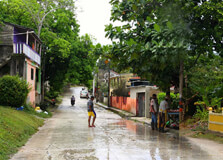
La Loma is a picturesque village located in the heart of San Andrés Island, Colombia. Known for its rich cultural heritage, traditional architecture, and breathtaking panoramic views, La Loma offers visitors a unique glimpse into the island's history and lifestyle. How to Reach La Loma, San Andrés Reaching La Loma is relatively straightforward: By Car: From the main town of San Andrés, head southeast on Avenida Las Américas. Continue straight until you reach the intersection with Calle 5. Turn left onto Calle 5 and follow the road until you see signs directing you to La Loma. The journey takes approximately 15 minutes. Public Transportation: Local buses or 'mototaxis' labeled 'La Loma' can be boarded from Centro San Andrés. The fare is usually around 2,000 COP. Once you arrive in La Loma, you can ask the driver to drop you off near the viewpoint or the First Baptist Church. Walking: If you're staying nearby, you can walk to La Loma. From the town center, head southeast on Avenida Colombia and turn left onto Cl. 4 after about 500 meters. Continue walking on Cl. 4 for approximately 1.5 kilometers. The church and viewpoint will be on your right. Weather in La Loma La Loma enjoys a tropical climate with warm temperatures year-round. The current weather is: Temperature: 29°C (84°F) Conditions: Cloudy Forecast: Expect beautiful weather with clouds and sunshine in the coming days, with highs around 31°C (88°F) and lows around 27°C (80°F). Why La Loma is Famous La Loma is renowned for its deep historical roots and cultural significance. Founded in the 19th century, it began under a tamarind tree where the founder taught English-speaking former slaves and their descendants how to read using the Bible. The village is a symbol of the anti-slavery struggle and a cornerstone of the Raizal community's identity. The First Baptist Church, established in 1844, stands as a testament to the island's rich heritage and the enduring faith of its community. Entry and Visit Details Visitors are welcome to explore La Loma and its surroundings. While there may be a nominal entrance fee to certain attractions, it's best to check with local sources for the most current information. The village's location atop La Loma offers breathtaking panoramic views of the island, making it a popular spot for both spiritual reflection and photography. History and Architecture La Loma was established in the 19th century and is known for its traditional Anglo-Caribbean architecture. The First Baptist Church, constructed in 1896 using pine wood imported from Alabama, USA, was first built in Mobile, Alabama, then moved to New York City, disassembled, and shipped to San Andrés. Parishioners carried the foundations on their backs from the port to La Loma. The church's architecture reflects the style of large Anglican churches of Jamaica, featuring a white-walled structure with a red roof and a tall steeple offering scenic views of San Andrés. Things to Do Around La Loma Visit the Mirador de La Loma: Located near the church, this scenic spot offers breathtaking panoramic views of San Andrés and its surrounding turquoise waters. It's a favorite among photographers and nature lovers. On clear days, you can see other nearby islands, such as Providencia and Santa Catalina, on the horizon. Explore the Village: Take a leisurely stroll through La Loma to experience local life and enjoy the natural beauty. The village is known for its lush hills and vibrant community. Attend a Sunday Service: Experience the local culture by attending a Sunday service at the First Baptist Church, where you can enjoy gospel music infused with Calypso beats and witness the community's vibrant worship. Facts and Tips Historical Significance: La Loma is a symbol of the anti-slavery struggle and has been a central institution for the Raizal community. Architectural Marvel: The First Baptist Church's unique construction and location atop La Loma make it a must-visit for architecture enthusiasts. Best Time to Visit: Early mornings or late afternoons offer the best lighting for photos and a more serene experience. Wear Comfortable Shoes: The walk up to the church involves an incline, so it's advisable to wear comfortable footwear. Stay Hydrated: Carry water with you, especially if you're planning to hike or explore the area extensively.
Explore More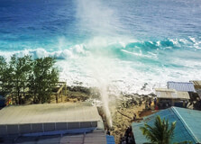
Hoyo Soplador, also known as the Blowhole, is a captivating natural attraction situated on the southern tip of San Andrés Island, Colombia. This geological marvel is a must-visit for travelers seeking to experience the island's unique coastal phenomena. How to Reach Hoyo Soplador, San Andrés Accessing Hoyo Soplador is straightforward: By Car: From the main town of San Andrés, head southeast on Avenida Las Américas. Continue straight until you reach the intersection with Calle 5. Turn left onto Calle 5 and follow the road until you see signs directing you to Hoyo Soplador. The journey takes approximately 15 minutes. Public Transportation: Local buses or 'mototaxis' labeled 'Hoyo Soplador' can be boarded from Centro San Andrés. The fare is usually around 2,000 COP. Once you arrive at the site, you can ask the driver to drop you off near the blowhole. Walking: If you're staying nearby, you can walk to Hoyo Soplador. From the town center, head southeast on Avenida Colombia and turn left onto Cl. 4 after about 500 meters. Continue walking on Cl. 4 for approximately 1.5 kilometers. The blowhole will be on your right. Weather in San Andrés San Andrés Island enjoys a tropical climate with warm temperatures year-round. The current weather is: Temperature: 29°C (84°F) Conditions: Cloudy Forecast: Expect beautiful weather with clouds and sunshine in the coming days, with highs around 31°C (88°F) and lows around 27°C (80°F). Why Hoyo Soplador is Famous Hoyo Soplador is renowned for its natural spectacle. The blowhole is a hole in the coral rock where seawater is forced through by wave pressure, creating a powerful jet of water that can reach up to 20 meters in height. This phenomenon is most impressive during high tide or rough seas, making it a popular attraction for visitors seeking to witness nature's power firsthand. Entry and Visit Details Access to Hoyo Soplador is free of charge. Visitors can explore the area at their own pace, but it's advisable to exercise caution due to slippery rocks and strong water jets. The site is open daily, and the best times to visit are during high tide or when the sea is rough, as these conditions produce the most dramatic displays. History and Architecture While Hoyo Soplador is a natural formation and not man-made, it holds cultural significance for the local community. The site has been a point of interest for both locals and tourists for many years, serving as a reminder of the island's dynamic coastal environment. The surrounding area features traditional Caribbean architecture, with colorful houses and lush vegetation adding to the charm of the location. Things to Do Around Hoyo Soplador Photography: Capture the impressive water jets and the surrounding coastal scenery. Nature Walks: Explore the nearby coastline and enjoy the natural beauty of the area. Swimming: While the blowhole itself is not suitable for swimming, nearby beaches offer opportunities for a refreshing dip. Local Cuisine: Sample traditional island dishes at nearby eateries. Facts and Tips Safety First: Always be cautious around the blowhole, as the rocks can be slippery and the water jets powerful. Best Time to Visit: High tide or rough seas offer the most dramatic displays. Footwear: Wear sturdy, non-slip shoes to navigate the rocky terrain safely. Stay Hydrated: Bring water, especially if you're planning to explore the area extensively. Respect Nature: Avoid disturbing the natural environment and dispose of trash responsibly.
Explore More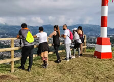
Cerro Canceles is a scenic hill located in Pereira, Risaralda, Colombia. Known for its panoramic 360-degree views of the city and surrounding landscapes, it has become a popular destination for both locals and tourists seeking a natural retreat and breathtaking vistas. How to Reach Cerro Canceles, Pereira Reaching Cerro Canceles is convenient: By Car: Drive towards the 'vía Cerritos' road from downtown Pereira. Continue to km 14, near the Santa Barbara service station, where the entrance is located. By Public Transport: Take a bus from Pereira's main terminal heading to Cerritos. Inform the driver to drop you at km 14. A short walk will lead you to the entrance. By Taxi: A taxi ride from the city center takes approximately 20 minutes directly to the park. Weather in Pereira Pereira experiences a tropical climate with consistent temperatures year-round. The current weather is: Temperature: 23°C (73°F) Conditions: Cloudy with afternoon showers Forecast: Similar weather with occasional thunderstorms expected in the coming days. Why Cerro Canceles is Famous Cerro Canceles is renowned for its stunning panoramic views, offering visitors a unique vantage point to observe the city of Pereira and its lush surroundings. The hill's natural beauty, combined with its accessibility, makes it a favorite spot for photography, relaxation, and nature appreciation. Entry and Visit Details Cerro Canceles is open to the public and does not require an entry fee. Visitors can explore the area at their leisure, enjoying the various trails and viewpoints. It's advisable to visit during daylight hours for safety and the best experience. History and Architecture While primarily a natural attraction, Cerro Canceles has been developed to enhance visitor experience, including the establishment of the "Mirador 360°" viewpoint. This addition allows for unobstructed views of the city and has become a symbol of Pereira's commitment to promoting eco-tourism and preserving natural landmarks. Things to Do at Cerro Canceles Visitors to Cerro Canceles can engage in various activities: Hiking: Explore the well-marked trails suitable for all fitness levels. Photography: Capture the breathtaking landscapes and cityscapes. Birdwatching: Observe diverse bird species in their natural habitat. Picnicking: Enjoy a meal amidst nature at designated spots. Relaxation: Find tranquility and unwind in the serene environment. Facts and Tips Best Time to Visit: Early morning or late afternoon for optimal lighting and fewer crowds. What to Bring: Comfortable walking shoes, water, sunscreen, and a camera. Safety: Stay on marked trails and be cautious of uneven terrain. Local Vendors: Support local artisans and vendors near the entrance. Weather Check: Always check the weather forecast before planning your visit.
Explore More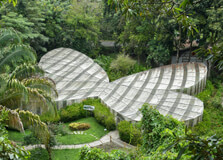
The Museo de Arte de Pereira is a prominent cultural institution located in Pereira, Colombia. It serves as a hub for modern and contemporary art, showcasing works by both Colombian and international artists. The museum is dedicated to promoting artistic expression and cultural education in the region. How to Reach Museo de Arte de Pereira The museum is situated at Avenida de las Américas #19-88 in Pereira. Visitors can reach the museum by various means: By Car: Accessible via major city roads with parking available nearby. By Public Transport: Local buses and taxis can take you directly to the museum's location. By Foot: For those staying in central Pereira, the museum is within walking distance. Weather in Pereira Pereira experiences a tropical climate with consistent temperatures throughout the year. The current weather is: Temperature: 23°C (73°F) Conditions: Cloudy with afternoon showers and thunderstorms Forecast: Similar weather patterns are expected in the coming days, with occasional thunderstorms. Why Museo de Arte de Pereira is Famous The museum is renowned for its extensive collection of modern and contemporary art, featuring works by notable artists such as Joan Miró and Robert Motherwell. It also hosts significant exhibitions like "Alter Natura," which explores the relationship between art and nature. :contentReference[oaicite:0]{index=0} Entry and Visit Details The museum operates with the following hours: Tuesday to Friday: 10:00 AM – 7:00 PM Saturday and Sunday: 10:00 AM – 5:00 PM Monday: Closed Admission fees are as follows: General Admission: Approximately 9,000 COP Students: Approximately 2,000 COP Foreign Tourists: Approximately 12,000 COP Note: Visitors may need to ring the doorbell ("timbre") for entry as the doors are kept locked for security. :contentReference[oaicite:1]{index=1} History and Architecture Established to foster the appreciation of modern art, the museum's architecture is designed to accommodate large-scale exhibitions and installations. Its spacious layout includes multiple floors dedicated to various art forms, providing an immersive experience for visitors. :contentReference[oaicite:2]{index=2} Things to Do at Museo de Arte de Pereira Visitors can engage in several activities: Explore Exhibitions: View rotating exhibits featuring contemporary art. Attend Workshops: Participate in educational programs and art workshops. Visit the Library: Access a collection of art literature and resources. Enjoy Guided Tours: Learn about the artworks through guided museum tours. Facts and Tips Photography: Photography may be restricted in certain areas; check signage. Accessibility: The museum is equipped with facilities for visitors with disabilities. Language: Exhibit descriptions are primarily in Spanish; consider hiring a guide if needed. Nearby ��Ӱֱ��: Combine your visit with nearby cultural sites in Pereira.
Explore More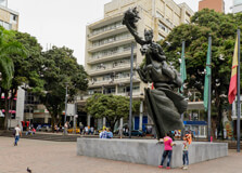
Plaza de Bolívar is the central square of Pereira, Colombia, serving as a vibrant hub of cultural, historical, and social significance. Located in the heart of the city, it is a popular gathering place for locals and tourists alike, offering a blend of history, architecture, and daily life. How to Reach Plaza de Bolívar, Pereira Situated in the city center, Plaza de Bolívar is easily accessible: By Car: Drive to the city center; parking is available in nearby streets and parking lots. By Public Transport: Local buses and taxis frequently service the area. On Foot: For those staying downtown, the plaza is within walking distance. Weather in Pereira Pereira experiences a tropical climate with consistent temperatures year-round. The current weather is: Temperature: 23°C (73°F) Conditions: Cloudy with afternoon showers and thunderstorms Forecast: Similar weather patterns are expected in the coming days, with occasional thunderstorms. Why Plaza de Bolívar is Famous The plaza is renowned for its iconic statue of Simón Bolívar, known as "Bolívar Desnudo" (Naked Bolívar), a unique depiction of the liberator. It serves as a central meeting point and is surrounded by significant landmarks, including the Cathedral of Our Lady of Poverty. :contentReference[oaicite:0]{index=0} Entry and Visit Details Plaza de Bolívar is a public space open to everyone, free of charge. It is accessible at all times, but visiting during daylight hours is recommended for safety and to fully appreciate the surroundings. History and Architecture The plaza has been a focal point of Pereira since its founding. The "Bolívar Desnudo" statue, created by artist Rodrigo Arenas Betancur, stands as a testament to the city's appreciation for its historical heritage. :contentReference[oaicite:1]{index=1} The surrounding architecture reflects a blend of colonial and modern influences, with notable buildings like the Cathedral of Our Lady of Poverty adding to its charm. :contentReference[oaicite:2]{index=2} Things to Do at Plaza de Bolívar Visitors can enjoy various activities: People-Watching: Observe the daily life of locals and street performers. Photography: Capture images of the unique statue and surrounding architecture. Local Cuisine: Sample traditional snacks from nearby vendors. Relaxation: Sit on benches and enjoy the ambiance of the plaza. Facts and Tips Best Time to Visit: Late afternoon when the weather is cooler and the atmosphere livelier. :contentReference[oaicite:3]{index=3} Nearby ��Ӱֱ��: Visit the Cathedral of Our Lady of Poverty and explore local cafes. Safety: The area is generally safe, but it's advisable to remain vigilant, especially at night. Events: Check local listings for cultural events or performances happening in the plaza during your visit. :contentReference[oaicite:4]{index=4}
Explore More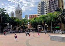
Plaza de los Limones is a charming public square located in Pereira, Colombia. Known for its tranquil ambiance and local significance, the plaza serves as a gathering spot for residents and visitors alike. While not as prominent as some of the city's major landmarks, it offers a glimpse into the everyday life and culture of Pereira. How to Reach Plaza de los Limones, Pereira The plaza is situated within the urban area of Pereira, making it accessible by various modes of transportation: By Car: Local roads connect to the plaza, with parking available in nearby areas. By Public Transport: City buses and taxis frequently service the area, providing convenient access. On Foot: For those staying nearby, the plaza is within walking distance. Weather in Pereira Pereira experiences a tropical climate with consistent temperatures throughout the year. The current weather is: Temperature: 23°C (73°F) Conditions: Cloudy with afternoon showers and thunderstorms Forecast: Similar weather patterns are expected in the coming days, with occasional thunderstorms. Why Plaza de los Limones is Famous While not widely known as a tourist attraction, Plaza de los Limones holds local significance as a communal space. It provides a peaceful environment for relaxation and social interaction, reflecting the community-oriented culture of Pereira. Entry and Visit Details Plaza de los Limones is a public space open to everyone, free of charge. It is accessible at all times, but visiting during daylight hours is recommended for safety and to fully appreciate the surroundings. History and Architecture Specific historical and architectural details about Plaza de los Limones are limited. However, like many public squares in Colombia, it likely features traditional design elements and serves as a testament to the city's development and community planning. Things to Do at Plaza de los Limones Visitors can enjoy various activities: Relaxation: Sit on benches and enjoy the serene atmosphere. People-Watching: Observe the daily life of locals and street activities. Photography: Capture images of the plaza and its surroundings. Local Cuisine: Sample traditional snacks from nearby vendors. Facts and Tips Best Time to Visit: Late afternoon when the weather is cooler and the atmosphere is lively. Nearby ��Ӱֱ��: Explore other parts of Pereira to experience the city's diverse offerings. Safety: The area is generally safe, but it's advisable to remain vigilant, especially at night. Events: Check local listings for any community events or performances happening in the plaza during your visit.
Explore More
La Virginia is a municipality located in the Risaralda Department of Colombia, approximately 50 kilometers west of Pereira, the departmental capital. Situated at an elevation of 899 meters (2,949 feet), it serves as a gateway between the Coffee Cultural Landscape and the Pacific lowlands. With a population of around 28,488 as of 2023, La Virginia offers visitors a blend of cultural experiences and natural beauty. :contentReference[oaicite:0]{index=0} How to Reach La Virginia, Pereira La Virginia is accessible via various modes of transportation: By Car: From Pereira, take the Autopista del Café westward for approximately 50 kilometers. By Bus: Regular bus services operate between Pereira and La Virginia, with departures from Pereira's main bus terminal. By Air: The nearest airport is Matecaña International Airport in Pereira. From there, travelers can continue by road to La Virginia. Weather in La Virginia La Virginia experiences a tropical climate with consistent temperatures throughout the year. The current weather is: Temperature: 23°C (73°F) Conditions: Cloudy with a couple of showers and a thunderstorm in the afternoon Forecast: Similar weather patterns are expected in the coming days, with occasional thunderstorms. Why La Virginia is Famous La Virginia is known for its strategic location as a transportation hub connecting the Coffee Region with the Pacific coast. The town's proximity to the Cauca River has historically made it an important center for commerce and trade. Additionally, its cultural festivals and natural attractions draw visitors seeking authentic Colombian experiences. Entry and Visit Details La Virginia is open to visitors year-round. There are no entry fees to access the town itself. However, specific attractions or events may have associated costs. It's advisable to check local schedules for festivals or special events when planning your visit. History and Architecture Founded in the mid-20th century, La Virginia has developed as a key municipality within Risaralda. The town's architecture reflects a blend of traditional Colombian styles and modern influences. Notable structures include colonial-era churches and public buildings that showcase the region's historical evolution. Things to Do in La Virginia Visitors to La Virginia can enjoy a variety of activities: Explore Local Markets: Experience the vibrant atmosphere of local markets offering fresh produce and artisanal goods. Attend Cultural Festivals: Participate in traditional festivals that celebrate the town's heritage and community spirit. Visit Natural ��Ӱֱ��: Discover nearby natural sites, such as riverbanks and scenic viewpoints, ideal for relaxation and photography. Sample Local Cuisine: Enjoy traditional Colombian dishes at local eateries, offering authentic flavors of the region. Facts and Tips Best Time to Visit: The dry season, typically from December to February, offers pleasant weather for outdoor activities. Language: Spanish is the predominant language; learning basic phrases can enhance your experience. Currency: The Colombian Peso (COP) is the local currency; it's advisable to carry cash for small purchases. Safety: La Virginia is generally safe for tourists, but standard precautions should be taken, especially at night. Transportation: Local buses and taxis are available for getting around town and to nearby attractions.
Explore More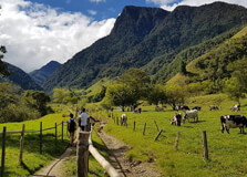
Cocora Valley (Valle de Cocora) is a breathtaking natural wonder located in the Quindío department of Colombia, near the town of Salento. Renowned for its towering wax palm trees—the tallest in the world and Colombia's national tree—the valley offers visitors a unique blend of lush landscapes, diverse wildlife, and rich cultural heritage. :contentReference[oaicite:0]{index=0} How to Reach Cocora Valley, Pereira To visit Cocora Valley, most travelers base themselves in Salento, a charming town approximately 24 kilometers from the valley. From Salento's main square, you can catch a traditional "Willy" jeep that transports visitors to the valley's entrance. These jeeps depart regularly, especially in the morning, and the ride takes about 20–30 minutes. :contentReference[oaicite:1]{index=1} Weather in Cocora Valley Cocora Valley experiences a subtropical highland climate, characterized by mild temperatures and frequent rainfall. Temperatures typically range between 12°C and 25°C (54°F to 77°F). Due to its elevation and proximity to the Andes, the valley often has cloudy conditions with sudden rain showers, so it's advisable to dress in layers and carry rain gear. :contentReference[oaicite:2]{index=2} Why Cocora Valley is Famous Cocora Valley is globally recognized for its majestic wax palm trees (Ceroxylon quindiuense), which can reach heights of up to 60 meters (200 feet). These trees are not only the tallest palm species in the world but also hold cultural significance as Colombia's national tree. The valley's unique ecosystem, part of the Los Nevados National Natural Park, supports a diverse range of flora and fauna, making it a haven for nature enthusiasts and hikers. :contentReference[oaicite:3]{index=3} Entry and Visit Details Access to Cocora Valley is subject to a modest entrance fee, which contributes to the conservation of the area. The main hiking loop requires a fee of approximately 11,000 COP (about $2.50 USD). Additional charges may apply for specific attractions, such as the Acaime Hummingbird Sanctuary. The valley is open daily from early morning until around 6 PM. :contentReference[oaicite:4]{index=4} History and Architecture The name "Cocora" honors a Quimbayan princess and translates to "star of water." In 1985, the Colombian government established the Los Nevados National Natural Park to protect the wax palm and its surrounding ecosystem. While the valley doesn't feature traditional architecture, its natural "architecture"—the towering palms set against misty mountains—offers a surreal and picturesque landscape. :contentReference[oaicite:5]{index=5} Things to Do in Cocora Valley Visitors to Cocora Valley can engage in various activities: Hiking: Embark on the main loop trail, a 12 km (7.5 miles) hike that takes approximately 5–7 hours, offering views of cloud forests, rivers, and wax palms. :contentReference[oaicite:6]{index=6} Bird Watching: Spot diverse bird species, including hummingbirds and the endangered yellow-eared parrot. :contentReference[oaicite:7]{index=7} Horseback Riding: Explore the valley on horseback through guided tours. :contentReference[oaicite:8]{index=8} Visit Acaime Sanctuary: A detour on the hiking trail leads to this hummingbird sanctuary, where visitors can observe various species up close. :contentReference[oaicite:9]{index=9} Facts and Tips Best Time to Visit: Early mornings are ideal to avoid crowds and afternoon rain showers. :contentReference[oaicite:10]{index=10} What to Bring: Sturdy hiking boots, rain gear, water, snacks, sunscreen, and a camera. :contentReference[oaicite:11]{index=11} Altitude: The valley sits between 1,800 and 2,400 meters (5,900 to 7,900 feet) above sea level; acclimatization may be necessary for some visitors. :contentReference[oaicite:12]{index=12} Conservation Efforts: The establishment of the national park has been crucial in protecting the wax palm and its ecosystem. :contentReference[oaicite:13]{index=13}
Explore More
Nevado del Ruiz is a majestic stratovolcano located in the Andes Mountains of Colombia, straddling the departments of Caldas and Tolima. Rising to an elevation of 5,321 meters (17,457 feet), it is one of the highest peaks in the country and is renowned for its snow-capped summit and glacial landscapes. The volcano is part of the Los Nevados National Natural Park, a protected area that encompasses several other volcanoes and diverse ecosystems. Nevado del Ruiz is not only a natural wonder but also a site of historical significance due to its volcanic activity. How to Reach Nevado del Ruiz Volcano, Manizales The most common access point to Nevado del Ruiz is through the city of Manizales, which is well-connected by road and air to major Colombian cities. From Manizales, travelers can take the route towards the Termales del Ruiz, a popular hot springs resort located at approximately 3,500 meters above sea level. Continuing past the resort, visitors reach the Brisas sector, the main entrance to Los Nevados National Natural Park. The park's entrance is situated at an altitude of around 4,000 meters. From there, guided tours can take visitors further up the volcano, depending on weather conditions and volcanic activity. It is essential to check the current status of the volcano and park access before planning a visit. Weather at Nevado del Ruiz Volcano Due to its high elevation, Nevado del Ruiz experiences cold temperatures year-round, with averages ranging between -2°C to 5°C (28°F to 41°F). The weather can change rapidly, with sudden snowstorms and fog common at higher altitudes. The best time to visit is during the dry seasons, which typically occur from December to March and July to August. During these periods, the weather is more stable, offering clearer views and safer hiking conditions. Visitors should always be prepared for cold and unpredictable weather, regardless of the season. Visiting Hours and Entry Details Los Nevados National Natural Park is open to visitors from Monday to Sunday, with entry permitted between 7:00 a.m. and 2:00 p.m. Visitors must exit the park by 5:00 p.m. It is mandatory to enter the park with a certified guide, especially when venturing beyond certain altitudes. The park authorities may restrict access to specific areas based on volcanic activity levels, weather conditions, and conservation efforts. It is advisable to check the official website or contact park officials for the latest information before planning a visit. Why Nevado del Ruiz is Famous Nevado del Ruiz is internationally known for its tragic eruption on November 13, 1985, which led to the Armero tragedy. A small eruption melted part of the mountain's ice cap, triggering massive lahars (volcanic mudflows) that buried the town of Armero, resulting in the deaths of over 23,000 people. This disaster highlighted the dangers of volcanic activity and the importance of disaster preparedness. Today, the volcano is closely monitored, and it serves as a case study in volcanic risk management. Beyond its history, Nevado del Ruiz attracts visitors for its stunning glacial landscapes, diverse ecosystems, and opportunities for mountaineering and ecological tourism. History and Geological Features Nevado del Ruiz has been active for over two million years, with its current volcanic cone forming approximately 150,000 years ago. It is a stratovolcano composed of alternating layers of lava, ash, and other volcanic materials. The volcano's summit features the Arenas crater, which is about 1 kilometer wide and 240 meters deep. Eruptions have been documented since 1570, with varying degrees of intensity. The volcano's activity has shaped the surrounding landscape, creating valleys, moraines, and other geological features. The presence of glaciers and snowfields adds to the mountain's dramatic appearance and contributes to its hydrological significance. Things to Do at Nevado del Ruiz Visitors to Nevado del Ruiz can engage in various activities that showcase the area's natural beauty and geological significance: Hiking and Trekking: Numerous trails offer opportunities to explore the páramo ecosystem, glacial landscapes, and panoramic views of the Andes. Wildlife Observation: The park is home to unique flora and fauna, including the endangered mountain tapir and spectacled bear. Birdwatchers can spot species like the Andean condor and buffy helmetcrest hummingbird. Photography: The contrasting landscapes of snow-capped peaks, lush valleys, and volcanic features provide stunning photographic opportunities. Hot Springs: Nearby thermal resorts, such as Termales del Ruiz, offer relaxing experiences in natural hot springs, warmed by the volcano's geothermal activity. Educational Tours: Guided tours provide insights into the volcano's geology, history, and the importance of conservation efforts in the region. Interesting Facts about Nevado del Ruiz Nevado del Ruiz is part of the Pacific Ring of Fire, a region known for its seismic and volcanic activity. The volcano's glaciers have been retreating due to climate change, with significant reductions observed over the past decades. The surrounding Los Nevados National Natural Park covers an area of approximately 58,300 hectares and includes other notable peaks like Nevado del Tolima and Nevado de Santa Isabel. The park's ecosystems range from Andean forests to high-altitude páramos, supporting a wide variety of plant and animal species. The volcano continues to be monitored by the Colombian Geological Survey to ensure public safety and provide early warnings of potential eruptions. Tips for Visiting Nevado del Ruiz Acclimatize: Spend time at intermediate altitudes to adjust to the high elevation and reduce the risk of altitude sickness. Dress Appropriately: Wear layered clothing to adapt to changing temperatures and conditions. Waterproof and windproof outer layers are recommended. Stay Informed: Check the current volcanic activity status and weather forecasts before your visit. Hire a Guide: Certified guides enhance safety and provide valuable information about the area's geology and ecology. Respect the Environment: Follow park regulations, stay on designated trails, and avoid disturbing wildlife to preserve the natural habitat. Hydrate and Nourish: Bring sufficient water and high-energy snacks to maintain energy levels during hikes.
Explore More
Chipre Viewpoint, locally known as "Torre de Chipre," is a prominent landmark situated in the Chipre neighborhood of Manizales, Colombia. This elevated spot offers panoramic views of the city and its surrounding mountainous landscapes, making it a must-visit destination for both locals and tourists. How to Reach Chipre Viewpoint, Manizales The Chipre Viewpoint is easily accessible from the center of Manizales. Visitors can reach the site by: Public Transportation: Local buses and taxis frequently service the route to the Chipre neighborhood. Private Vehicle: There are parking options available near the viewpoint for those driving. The access to the viewpoint is straightforward and does not require long walks, making it an ideal option for all visitors. Weather at Chipre Viewpoint, Manizales Manizales experiences a subtropical highland climate, characterized by mild temperatures year-round. Visitors can expect temperatures ranging from 15°C to 22°C (59°F to 72°F). The city experiences frequent rainfall, especially during the rainy seasons from March to May and September to November. It's advisable to carry a light jacket and an umbrella when visiting. Timings of Chipre Viewpoint The Chipre Viewpoint is open to the public daily. While the exact operating hours may vary, it's generally accessible from early morning until evening. It's recommended to visit during daylight hours to fully appreciate the panoramic views and ensure safety. Why is Chipre Viewpoint Famous? Chipre Viewpoint is renowned for its breathtaking 360-degree views of Manizales and the surrounding Andean mountains. The viewpoint offers a unique perspective of the city, with its terraced hills, coffee plantations, and distant snow-capped peaks. It's also a popular spot for watching the sunset, as the sky transforms into a canvas of vibrant colors. Entry and Visit Details Visiting the Chipre Viewpoint is free of charge. There are no formal entry requirements, making it accessible to everyone. However, visitors are encouraged to respect the local community and maintain the cleanliness of the area. History and Architecture The Chipre Viewpoint is situated in the historic Chipre neighborhood, one of the oldest areas of Manizales. The neighborhood was originally established in the late 19th century and has since developed into a vibrant community. The viewpoint itself is a modern structure that has become an iconic symbol of the city. Its design incorporates elements that blend harmoniously with the natural surroundings, offering both aesthetic appeal and functionality. Things to Do at Chipre Viewpoint Visitors to Chipre Viewpoint can engage in various activities: Photography: Capture stunning panoramic views of Manizales and the Andean mountains. Relaxation: Enjoy the tranquil atmosphere and scenic beauty of the area. Sunset Viewing: Witness the breathtaking sunsets that paint the sky with vibrant colors. Local Exploration: Explore the Chipre neighborhood and experience the local culture and cuisine. Facts and Tips about Chipre Viewpoint Best Time to Visit: Late afternoon, just before sunset, offers the most spectacular views. What to Bring: A camera, comfortable walking shoes, and a light jacket. Accessibility: The viewpoint is wheelchair accessible, but it's advisable to check current conditions before visiting. Safety: While the area is generally safe, it's recommended to visit during daylight hours and avoid isolated spots after dark. Conclusion Chipre Viewpoint in Manizales offers a unique opportunity to experience the natural beauty and cultural richness of the region. Whether you're a nature enthusiast, a photography lover, or someone seeking a peaceful retreat, the viewpoint provides a memorable experience. Its accessibility, combined with the stunning vistas, makes it a must-visit destination in Manizales.
Explore More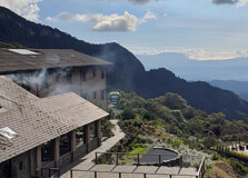
Termales del Ruiz is a renowned natural hot spring resort located in the heart of Colombia's Andean region, specifically in the municipality of Villamaría, near Manizales. Situated at an impressive altitude of 3,500 meters above sea level, this destination offers visitors a unique blend of relaxation, adventure, and natural beauty. The resort is nestled within the Los Nevados National Natural Park, providing a serene escape surrounded by lush paramo landscapes and volcanic terrains. How to Reach Termales del Ruiz, Manizales Accessing Termales del Ruiz requires a journey through mountainous terrain, making it an adventure in itself. From Manizales, visitors can: Private Vehicle: Drive approximately 36 kilometers to the resort. The route involves navigating winding mountain roads, so it's advisable to use a 4x4 vehicle, especially during the rainy season. Public Transport: Take a bus from Manizales to Villamaría, then arrange for a local taxi or shuttle to the resort. The journey offers scenic views of the surrounding mountains. Guided Tours: Many local tour operators offer packages that include transportation, meals, and guided tours of the area. Weather at Termales del Ruiz, Manizales The climate at Termales del Ruiz is characterized by cool temperatures due to its high altitude. Visitors can expect: Daytime Temperatures: Ranging from 15°C to 20°C (59°F to 68°F). Nighttime Temperatures: Dropping to 5°C to 10°C (41°F to 50°F). Rainfall: Occasional showers, particularly during the rainy seasons from March to May and September to November. It's advisable to dress in layers and carry a waterproof jacket to stay comfortable during your visit. Timings of Termales del Ruiz, Manizales The resort operates daily, with the following general timings: Day Visitors: Typically welcome from 9:00 AM to 5:00 PM. Overnight Guests: Check-in usually begins at 3:00 PM, with check-out by 12:00 PM the following day. It's recommended to confirm specific timings and availability in advance, especially during peak seasons or holidays. Why is Termales del Ruiz Famous? Termales del Ruiz is celebrated for several reasons: Natural Hot Springs: The resort boasts volcanic hot spring pools that offer therapeutic benefits amidst stunning mountain views. Proximity to Nevado del Ruiz: Located near the active Nevado del Ruiz volcano, visitors can explore the surrounding national park and its unique ecosystems. Birdwatching Opportunities: The area is home to diverse bird species, making it a haven for bird enthusiasts. Adventure Activities: Guests can engage in hiking, nature walks, and photography in the surrounding landscapes. Entry and Visit Details about Termales del Ruiz, Manizales Visitors can enjoy the resort's facilities through: Day Passes: Allow access to the hot springs and certain amenities for a set fee. Overnight Stays: Include accommodation, meals, and full access to the resort's facilities. It's advisable to book in advance, especially during weekends and holidays, as the resort can be fully booked due to its popularity. History and Architecture of Termales del Ruiz, Manizales Termales del Ruiz has a rich history intertwined with the region's volcanic activity. The resort's hot springs have been utilized for centuries, with indigenous communities recognizing their therapeutic properties long before modern development. The architecture of the resort blends traditional Andean designs with modern amenities, ensuring comfort while maintaining harmony with the natural surroundings. Things to Do at Termales del Ruiz, Manizales Visitors to Termales del Ruiz can indulge in a variety of activities: Relax in Hot Springs: Soak in the mineral-rich volcanic pools, known for their therapeutic properties. Hiking: Explore trails within the Los Nevados National Natural Park, offering breathtaking views and diverse ecosystems. Birdwatching: Spot various bird species native to the Andean region. Photography: Capture the stunning landscapes, waterfalls, and wildlife. Wellness Treatments: Some packages offer spa services, including massages and wellness therapies. Facts and Tips about Termales del Ruiz, Manizales Altitude Considerations: The high altitude may cause mild altitude sickness; it's advisable to acclimatize and stay hydrated. What to Pack: Bring warm clothing, waterproof gear, and sturdy footwear for hiking. Health Precautions: Consult with a healthcare provider before visiting if you have respiratory or heart conditions. Respect Nature: Follow all guidelines to preserve the natural environment and wildlife. Local Cuisine: Don't miss out on traditional Colombian dishes offered at the resort's restaurant. Conclusion Termales del Ruiz offers a unique blend of relaxation, adventure, and natural beauty. Whether you're seeking therapeutic hot springs, thrilling hikes, or a peaceful retreat amidst nature, this destination provides an unforgettable experience. Proper preparation and respect for the environment will ensure a memorable visit to this Andean gem.
Explore More